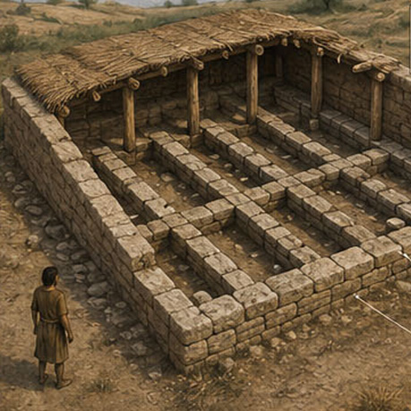
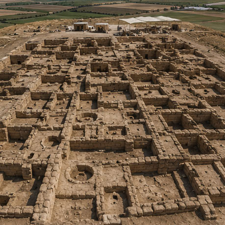
Monumental architecture and ancient settlements examined within the museum’s Pre-Flood collection context.
The structures are here. The ruins are here. The evidence is here.
A Message from the Curator
Welcome to Ancient Architecture & Settlements
Beneath our feet lies a human story far more complex than the ruins visible on the surface. Across continents, archaeologists have uncovered buried settlements, enormous stone enclosures, subterranean chambers, precisely fitted masonry, engineered waterways, towers, monumental pillars, and entire communities that had disappeared from human memory.
From historical records, archaeological investigation, scientific measurement, and the physical evidence preserved in the ground, some of these places are believed to stand among the oldest known monumental structures created by human hands. Yet the farther we travel into this architectural record, the more fundamental the questions become. Who were the builders? What tools did they possess? How did they organize labor, quarry stone, shape it, move it, and raise it? Why were certain structures aligned toward particular features of the landscape or sky? Why were some abandoned, damaged, buried, or forgotten? Discovery for yourself, Ancient Architecture & Settlements.
David PinterCurator, Archoseum
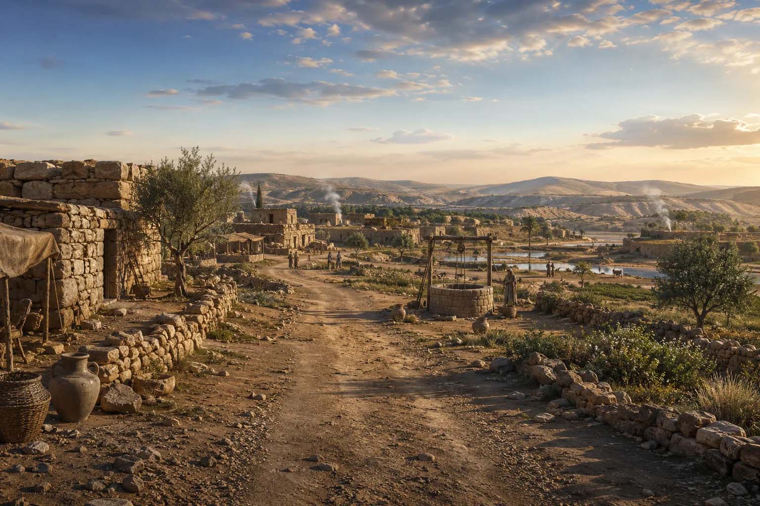
EXAMPLE OF AN ANCIENT SETTLEMENT
An Interactive Archaeological Journey
Immersive Experience
Road to the Well
Walk Through an Ancient Settlement
Enter an interpretive reconstruction of an ancient Near Eastern settlement. Follow the road to the well, turn into the village street, investigate a shuttered dwelling, and examine reconstructed vessels alongside their excavated archaeological counterparts.
Enter the Settlement →
Interactive reconstruction · ambient audio is optional · archaeological reference objects are identified in context.
EXPLORE THE COLLECTION
Ancient Architecture & Settlements
Open an exhibit below to explore ancient cities, settlements, temples, fortifications, engineering, excavation history, and the physical evidence left by their builders.
◆
01Exhibit 01The City of EnochLocation unknown, Biblical textual landmark
The City of Enoch
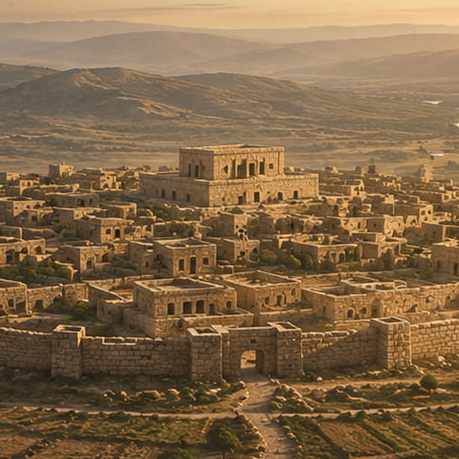
Genesis preserves the memory of a city associated with Cain and named for his son Enoch. Its archaeological location has not been identified, and Scripture does not describe its architecture in enough detail for a literal reconstruction. The illustration below is therefore intentionally imaginative: a visual concept of an early city built from locally available stone and earth, viewed from the surrounding high country. It is included to give the visitor a sense of the biblical narrative while keeping a clear boundary between textual history and excavated archaeology.
Conceptual reconstruction. The City of Enoch has not been archaeologically identified. This illustration visualizes the biblical city-building account in Genesis 4:17 and is not presented as a recovered site, measured plan, or known historical appearance.
Textually Attested / Location Unidentified
A city preserved in the written record
Genesis introduces city-building very early in its narrative. Cain is described as building a city and naming it after his son Enoch. No archaeological site has been securely identified with that city, and the biblical text does not preserve dimensions, building materials, street plans, fortifications, or a geographic location from which a literal reconstruction could be made.
“And he builded a city, and called the name of the city, after the name of his son, Enoch.” Genesis 4:17, KJV
For this museum, the City of Enoch is therefore treated as a textual landmark. It belongs in the journey because an ancient source describes it, but any architectural visualization must remain explicitly conceptual.
ContextBiblical Pre-Flood World
SourceGenesis 4:17
Physical SiteNot identified
StatusTextually attested
Important Name Distinction
Two Men Named Enoch
The biblical record contains two different men named Enoch. The City of Enoch in Genesis 4:17 was named for Enoch, the son of Cain. He should not be confused with Enoch, the son of Jared, who appears later in Genesis 5 and is the Enoch associated with the Enochic literary tradition.
ENOCH, SON OF CAINGenesis 4:17
Son of Cain. Cain built a city and named it after this Enoch.
ENOCH, SON OF JAREDGenesis 5:18–24
The later patriarch who “walked with God.” This is the Enoch associated with the Enochic literary tradition.
They are not the same person. The Book of Enoch is therefore not used here as independent evidence for Cain’s City of Enoch merely because it bears the name Enoch.
Comparative Ancient Writings
The City in Other Ancient Sources
NON-CANONICAL / HISTORICAL TRADITION
The writings below are included for historical comparison. They are not presented by this museum as canonical Scripture and do not carry the same status as the biblical text.
NON-CANONICAL
Book of Jubilees
Jubilees 4 identifies Cain’s wife as Âwân (Awan), says she bore Enoch, and places the building of Cain’s city in the same narrative period in which “houses were built on the earth.” Cain then names the city after his son Enoch.
ANCIENT JEWISH HISTORIAN · NON-CANONICAL
Josephus
In Antiquities of the Jews, Book I, Josephus says Cain established boundaries around lands, introduced measures and weights, built a city, fortified it with walls, gathered his family into it, and called the city Enoch after his son.
EARLY CHRISTIAN WRITER · NON-CANONICAL
Theophilus of Antioch
In To Autolycus, Book II, Chapter 30, Theophilus repeats that Cain had a son named Enoch and built a city bearing his son’s name. He specifically describes this as the beginning of city-building before the Flood.
02Exhibit 02Göbekli TepeGermuş Mountains, Şanlıurfa Province, Türkiye
Göbekli Tepe
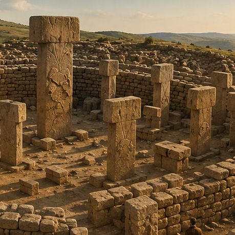
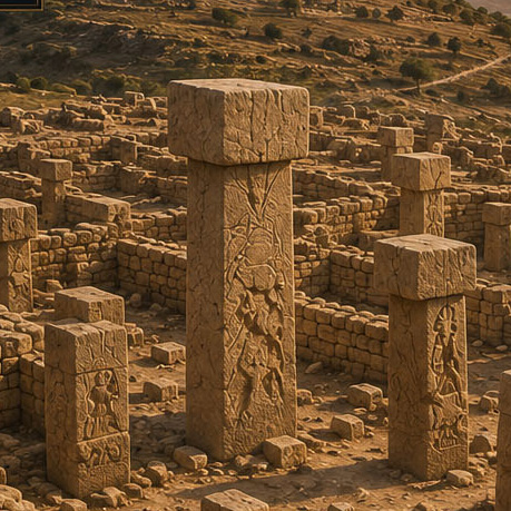
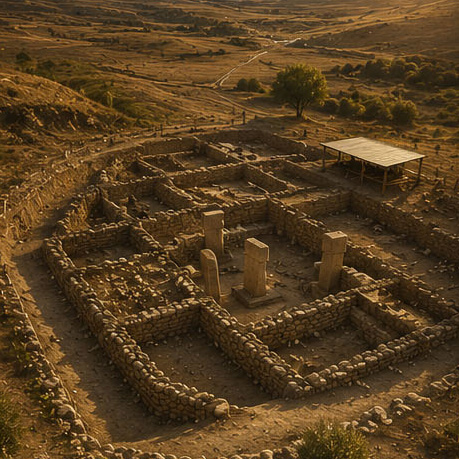
At the edge of what we can presently trace of monumental human architecture stands Göbekli Tepe. Excavation has exposed immense limestone enclosures containing distinctive T-shaped monoliths, some carrying carved animals and unmistakably anthropomorphic details such as arms, hands, belts, and garments. The stones themselves provide the starting point for this exhibit. There is no surviving inscription naming the builders, no recovered text explaining the original purpose, and no single observation that tells us why the structures eventually disappeared beneath the hill.
Interpretive museum illustration based on the excavated monumental architecture at Göbekli Tepe. The illustration is not a account that every pictured pillar stood simultaneously in this exact arrangement. The 5 ft 6 in human figure provides scale.
PeriodPre-Pottery Neolithic
Museum ContextPre-Flood Architectural Sequence
LocationGermuş Mountains, Türkiye
ElevationAbout 786 m / 2,579 ft
Primary materialLocal limestone
Largest pillarsUp to about 5.5 m / 18 ft
Builder inscriptionNone known
Physical Record
What Is Actually There?
Feature
Physical record
Evidence class
T-shaped pillars
Large monolithic limestone pillars occur in monumental round-oval and rectangular structures.
Observed
Central monoliths
Several monumental buildings contain paired central T-pillars larger than surrounding wall pillars.
Observed
Pillar height
The largest known central pillars reach approximately 5.5 m / 18 ft.
Measured
Quarry source
The T-pillars were carved from the adjacent limestone plateau. Quarrying and unfinished stonework survive nearby.
Observed
Animal reliefs
Wild animals include snakes, foxes, boar, birds, aurochs, and other creatures.
Observed
Human characteristics
Some pillars carry arms, hands, belts, loincloth or garment-like elements.
Observed
Anthropomorphic interpretation
The combination of T-form, arms, hands, belts, and clothing leads researchers to interpret many pillars as stylized human figures.
Interpretation strongly grounded in imagery
Walls and benches
Stone walls and bench-like features occur around parts of monumental interiors.
Observed
Archaeological deposits
Excavated deposits include limestone rubble, worked stone and flint, animal remains, and small quantities of fragmented human bone.
Observed
The Pillars
Stone figures without names
UNESCO describes the site's distinctive T-pillars as anthropomorphic, and German Archaeological Institute documentation records carved arms, hands, clothing, belts, and other body-associated imagery. These details are important because they move the discussion beyond the simple statement that the stones are shaped like a letter T.
What the figures represented remains unknown. They may depict humans, ancestors, supernatural beings, idealized persons, or something that does not fit neatly into any of those modern categories.
Enclosures & Buildings
Observation
What it tells us
What it does not tell us
Round-oval monumental structures exist.
The builders planned enclosed communal spaces around prominent pillars.
It does not identify their original name or exact social function.
Rectangular buildings also occur.
The architecture changed and was rebuilt through multiple phases of use.
It does not require that every structure served the same function.
Some pillars were moved or reset.
The site experienced remodeling and architectural intervention during its ancient use.
The arrangement visible today cannot always be assumed to be the first arrangement.
Damage is documented.
Some pillars and buildings were disturbed, broken, toppled, or altered.
The site should not be described as having been found perfectly intact.
Deposits & Preservation
Why Was It Buried?
This is one of the most interesting places where interpretation has changed as excavation has continued. Earlier explanations often described the monumental buildings as deliberately and ceremonially filled. Recent research has complicated that picture.
Observed
Large volumes of material filled the structures
The excavated buildings contain substantial deposits including fist-sized limestone rubble, sediment, artifacts, animal bone, worked stone, and smaller quantities of fragmented human bone. Burial beneath these deposits contributed to the survival of walls, pillars, reliefs, and internal architectural relationships.
Evidence statement: The monumental structures were discovered beneath major accumulations of archaeological material. The composition of those deposits can be studied directly. The full process by which each deposit accumulated remains an archaeological question.
Preservation Condition
Question
Record
Were structures preserved beneath accumulated material?
Yes. Burial protected substantial portions of monumental architecture.
Was the entire site discovered perfectly intact?
No. Ancient disturbance, structural collapse, broken and displaced pillars, erosion, later activity, excavation, and conservation all form part of the site's history.
Are all monumental structures fully excavated?
No. Research and excavation continue, and substantial portions of the mound remain to be investigated.
Do we know why every structure ceased to be used?
No.
Source Context
Areas for Further Study
BuildersTheir names are unknown
No surviving inscription identifies an architect, ruler, tribe, or named builder.
Original nameUnknown
Göbekli Tepe is the modern name of the archaeological site.
Original purposeInterpreted
Communal, ritual, funerary, domestic, and mixed-use interpretations continue to be refined.
Burial mechanismUnder investigation
Different structures and deposits may not share one single formation history.
Curator's assessment: Göbekli Tepe does not need a declared age or an invented explanation to be extraordinary. The stone architecture, quarry evidence, carved imagery, human features, buried deposits, rebuilding, and unanswered questions already make it one of the most consequential archaeological discoveries in the study of early monumental construction.
Research Trail
Source family
What it contributes to this exhibit
UNESCO World Heritage Centre
Monument classification, limestone quarry relationship, T-shaped pillars, animal imagery, anthropomorphic interpretation, and international heritage documentation.
German Archaeological Institute (DAI)
Excavation history, pillar arrangement, architectural changes, anthropomorphic details, conservation, and continuing field research.
Kinzel and colleagues, DAI architectural research
Recent study of mound formation, architecture, buried topography, collapse, and the processes contributing to archaeological deposits.
03Exhibit 03Karahan TepeŞanlıurfa Province, Southeastern Türkiye
Karahan Tepe
Karahan Tepe expands the architectural world first encountered at Göbekli Tepe. Excavation has exposed T-shaped pillars, sculpted human imagery, rock-cut spaces, channels, benches, and architectural elements shaped directly from the limestone bedrock. Structure AB is especially remarkable because portions of the monument were not simply assembled from transported blocks: pillars and a human head were carved from the living rock itself. The physical remains are clear; exactly what the arrangement meant to its builders remains unknown.
Illustrative reconstruction. The image is intended to communicate the setting and monumental character of Karahan Tepe. The evidence tables below distinguish excavated features from interpretation.
A Different Kind of Monument
Karahan Tepe belongs to the remarkable concentration of early monumental sites surrounding Şanlıurfa in southeastern Türkiye. Excavation has revealed T-shaped stone pillars, sculpted human imagery, rock-cut spaces, channels, benches, and structures shaped directly from the limestone bedrock. Most striking is Structure AB, where the builders did not simply carry stones into a prepared room: they cut architectural elements directly from the living rock itself.
Site Profile
Period
Pre-Pottery Neolithic
Museum context
Pre-Flood architectural sequence within the biblical framework explored by this museum
Location
Tek Tek Mountains region, Şanlıurfa Province, southeastern Türkiye
Unknown; special or communal functions are archaeological interpretations
Structure AB
Structure AB is one of Karahan Tepe's most extraordinary excavated spaces. Archaeologist Necmi Karul describes the building as being created by cutting into the bedrock. Ten upright pillars were formed from the rock itself, with an additional stone element bringing the reported total to eleven.
Four especially prominent uprights stand approximately 1.6 to 1.7 meters high. A human head was also sculpted from the bedrock along the western side of the structure. The head faces toward the interior and the entrance stairs.
What Is Actually There?
Bedrock-cut pillars
Ten pillars reported as carved directly from the limestone bedrock in Structure AB
Additional upright
One further stone element was placed into a shallow bed
Prominent pillar height
Approximately 1.6 to 1.7 m for four of the carefully worked uprights
Human head
A sculpted human head projects from the bedrock wall
Human imagery
Sculpture and anthropomorphic imagery occur at the site
Channels
A serpentine channel opens into Structure AB from the north
Benches / ledges
Rock-cut and constructed architectural surfaces occur around the structure
Large stone covering elements
Large flat stones were found arranged over portions of Structure AB
The Human Head
The sculpted head is not a loose statue placed inside the room. It was shaped from the bedrock itself. Excavation reports describe a projecting forehead, thick lips, and a beard beneath the chin. Its position in relation to the stairs and the row of uprights makes it one of the site's most unusual surviving features.
Observed: A human head carved from the bedrock.
Observed: Upright elements arranged in front of it.
Interpretation: What the arrangement represented or what activity occurred here.
Unknown: The identity of the figure and the builders' name for the structure.
Was Structure AB Buried?
Here the evidence is particularly interesting. The excavation report argues that Structure AB was deliberately filled in a sequence of procedures. The fill remained confined within the structure, and the excavators interpreted the arrangement of deposits and large flat stones as evidence that the building boundaries were still visible while filling occurred.
That conclusion applies to this excavated structure and should not automatically be generalized to every buried monument in the region.
Engineering Questions
Karahan Tepe raises a different engineering question from monuments assembled entirely from transported blocks. Here, portions of the architecture were created by removing material from the bedrock until pillars, walls, channels, and sculptural forms remained.
The finished monument therefore records both construction and subtraction: stone was quarried and placed, while other features were carved out of the limestone beneath the builders' feet.
Evidence vs. Interpretation
Statement
Museum classification
T-shaped pillars and monumental stone architecture occur at Karahan Tepe.
Observed
Structure AB contains pillars carved directly from bedrock.
Observed
A human head was sculpted from the bedrock.
Observed
Structure AB was deliberately filled.
Excavator interpretation supported by the deposit pattern
The structure was a temple.
Interpretation, not directly established
The carved figures represent particular gods, ancestors, or supernatural beings.
Unknown / interpretive
The builders' identity and their name for Karahan Tepe are known.
No
Areas for Further Study
No surviving text tells us what the people who constructed Karahan Tepe called the site, what the carved human imagery represented, why particular structures were created, or what ceremonies or daily activities may have occurred within them. The architecture is real. The carvings are real. The arrangement can be measured. The meaning assigned to them requires interpretation.
04Exhibit 04BaalbekBaalbek, Beqaa Valley, Lebanon
Baalbek
Baalbek forces the visitor to confront scale. Its monumental complex contains some of the largest stone blocks successfully incorporated into ancient construction, while the nearby quarry preserves even larger blocks that were cut but never transported. Beneath the later sanctuary lies a much longer history of occupation. These different layers must be kept separate: ancient settlement at Baalbek does not by itself establish an early date for the colossal podium stones.
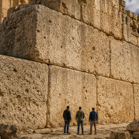
Megalith scale study. Left: the installed Trilithon. Center: the quarry and the Stone of the Pregnant Woman. Right: the still larger ancient cut block uncovered in the quarry. Human figures are included to communicate scale.
LocationBeqaa Valley, Lebanon
Primary MaterialLimestone
Installed MegalithsTrilithon
Largest Quarry BlockApprox. 1,650 metric tons
The Stones That Moved - And the Stones That Didn't
The most useful way to approach Baalbek is to distinguish successful construction from unfinished ambition. Three enormous limestone blocks known collectively as the Trilithon were transported and incorporated into the monumental podium. Each is commonly estimated in the range of roughly 750 to 800 metric tons.
In the nearby quarry, however, still larger stones remain. The famous Stone of the Pregnant Woman is generally estimated at about 1,000 metric tons. Archaeological work also exposed an even larger cut block estimated at approximately 1,650 metric tons. Those quarry stones were never installed. Their abandonment is part of the evidence and should not be confused with demonstrated transport capability.
What Is Actually There?
Feature
Physical evidence
Why it matters
Trilithon
Three colossal limestone blocks incorporated into the monumental podium.
Demonstrates that extremely heavy stones were successfully quarried, transported, positioned, and incorporated into construction.
Stone of the Pregnant Woman
Huge worked limestone block remaining in the ancient quarry.
Shows quarrying on a scale even greater than the installed Trilithon blocks, but does not demonstrate successful transport.
Largest Quarry Block
An even larger worked block exposed during archaeological investigation of the quarry.
At roughly 1,650 metric tons, it represents an extraordinary attempted scale of ancient stone extraction.
Quarry Work
Cut surfaces, extraction areas, working traces, and unfinished stone remain in the quarry landscape.
Provides direct evidence for how the blocks originated and where parts of the construction process took place.
Monumental Podium
Massive courses of masonry supporting the later sanctuary complex.
Separates the engineering question of the foundation and podium from the later standing temple architecture above it.
The Trilithon
The three famous blocks are not loose stones lying at the site. They form part of an enormous masonry course in the podium. That distinction is critical. Whatever methods were used, these blocks had to be extracted, moved from the quarry area, brought to the construction zone, aligned, and set into a massive architectural system.
Their existence therefore demonstrates successful heavy-stone engineering. It does not, by itself, identify the complete transport system, labor force, lifting sequence, or construction organization.
The Quarry
The quarry gives us the other half of the story. Here the visitor can see that ancient builders attempted blocks larger than those successfully installed. Some remained attached to or resting within the quarry and were abandoned before reaching the sanctuary.
That difference is valuable evidence. It suggests that ancient engineering had practical limits, setbacks, changing plans, or stone-quality problems just as large construction projects do today.
1,650 Tons - But Did It Ever Move?
No evidence demonstrates that the largest known quarry block was transported to the temple complex. It remains at the quarry. For this museum, its importance is therefore stated precisely: it demonstrates extraordinary quarrying ambition, not successful movement of a 1,650-ton stone.
A Settlement Beneath the Monument
Older Occupation
Archaeological investigation beneath the later monumental sanctuary has revealed a long sequence of human occupation, including settlement remains extending into the Pre-Pottery Neolithic. Houses, paths, burials, and later occupation accumulated in the area over a very long span of human activity.
This makes Baalbek much more than a Roman temple site. People occupied this landscape long before the surviving monumental sanctuary took its familiar form.
Do Not Collapse the Layers
The presence of early settlement beneath Baalbek does not establish that the Trilithon or quarry megaliths were created during that earliest occupation. Archaeological layers represent different episodes of activity.
For our collection, the early settlement and the colossal masonry belong on the same page because they occupy the same remarkable place, but they remain separate lines of evidence.
Giants, Jinn, and the Memory of Baalbek
Structures of exceptional scale often attract stories attempting to explain how they were built. Baalbek is no exception. Regional traditions have associated the enormous stones with jinn and other beings of extraordinary strength. The Stone of the Pregnant Woman itself carries folklore connected with its unusual name and supernatural builders or movers.
These traditions are culturally important, but they are not archaeological proof that giants or supernatural beings constructed Baalbek. They belong in a separate category: historical folklore inspired by extraordinary physical remains.
Observed · Interpreted · Unknown
Statement
Classification
Three exceptionally large limestone blocks were incorporated into the monumental podium.
Observed
The nearby quarry contains unfinished or abandoned megalithic blocks larger than the Trilithon stones.
Observed
The largest known ancient cut quarry block is estimated at roughly 1,650 metric tons.
Measured / estimated from dimensions and stone density
The 1,650-ton quarry block was successfully transported.
Not demonstrated
The complete sequence of techniques used to transport and position the Trilithon is known in every detail.
Unknown
The early settlement beneath the sanctuary built the Trilithon.
Not demonstrated
Stories of jinn or giant builders prove who constructed the megalithic masonry.
Folklore, not archaeological evidence
Curator's Assessment
Baalbek earns its place in this collection without requiring exaggeration. The installed stones are already extraordinary. The quarry demonstrates that ancient builders contemplated still greater masses. The unanswered engineering questions are legitimate, even when supernatural explanations cannot be established archaeologically.
That is precisely why Baalbek matters here: the physical evidence is astonishing enough to stand on its own.
Research Record
Research source
Contribution to this exhibit
German Archaeological Institute investigations at Baalbek
Excavation of the sanctuary and quarry, documentation of settlement layers, quarry activity, and the exceptionally large worked blocks.
Baalbek archaeological and architectural studies
Documentation of the monumental podium, Trilithon masonry, quarry relationship, construction sequence, and later sanctuary.
Historical and regional folklore records
Preservation of traditions concerning jinn, extraordinary builders, and explanations attached to the giant stones; treated separately from archaeological evidence.
05Exhibit 05ĠgantijaXagħra, Gozo, Malta
Ġgantija
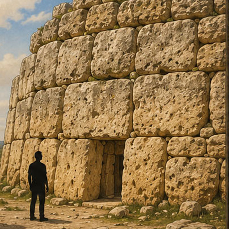
Ġgantija is monumental architecture with a name that remembers giants. Two adjoining prehistoric temples survive behind enormous limestone walls on the island of Gozo. Their façades, passages, apsidal chambers, orthostats, horizontal masonry, and massive exterior blocks reveal an organized building tradition of remarkable scale. Long after the original builders disappeared from memory, Gozitan folklore explained the stones through the story of a powerful giantess named Sansuna.
Illustrated scale study. Human silhouettes provide visual scale beside the surviving megalithic masonry. The artwork is interpretive and should be read together with the measured archaeological information below.
LocationXagħra, Gozo, Malta
ComplexTwo adjoining temples
Primary StoneLocal limestone
TraditionSansuna the Giantess
The Place of the Giants
The Maltese word ġgant means giant, and the name Ġgantija preserves the association between the monument and beings of extraordinary size or strength. Gozitan tradition held that the temples were built by a giantess. Heritage Malta records the tradition of Sansuna, a powerful giantess remembered as carrying megaliths across Gozo.
The folklore is not archaeological proof of giant builders. What makes it important to this museum is that the giant tradition belongs to the cultural memory of the place itself. It was not created merely as a modern explanation for unusual photographs.
Architecture and Dimensions
Feature
Physical description
What matters
Temple Complex
Two adjoining monumental structures contained within a massive external enclosure.
The site represents planned monumental construction rather than an isolated standing stone.
Exterior Walls
Large limestone blocks form thick enclosing walls, with some stones standing several metres high.
The exterior creates the strongest impression of the extraordinary scale that inspired the site's name and folklore.
Orthostats
Large upright stone slabs form façades, passages, and interior architectural elements.
Vertical slabs were deliberately positioned as structural components rather than simply piled as rubble.
Horizontal Courses
Surviving courses occur above upright masonry.
They provide evidence used in reconstructing a corbelled roofing system.
Interior Plan
Monumental entrances lead into courts and rounded or semi-circular chambers commonly called apses.
The architecture follows an organized internal plan rather than a single open enclosure.
World Heritage Property
The Ġgantija component occupies about 0.715 hectares within its UNESCO boundary.
The protected archaeological complex extends beyond any single wall or chamber visible in photographs.
How the Walls Were Built
The Maltese temple tradition used large upright slabs together with horizontal stone courses. UNESCO describes external walls built from larger blocks and internal chambers formed around monumental orthostats. Spaces between inner and outer wall faces were packed with stone and earth, binding the construction together.
The builders also selected different local limestones according to architectural need. Harder coralline limestone was particularly useful for exposed exterior construction, while softer globigerina limestone could be used in more sheltered or worked contexts.
Was It Roofed?
Surviving horizontal masonry courses are important because they support the interpretation that at least parts of the Maltese temples originally had corbelled roofs, probably completed with horizontal elements across the narrowing upper span.
Observed: upright slabs and surviving horizontal courses. Interpretation: corbelled roofing. Unknown: the complete appearance, height, and finishing of every original roof.
Why Would Giants Be Remembered Here?
The stones themselves provide one possible explanation. When later inhabitants encountered monumental masonry whose builders and construction process were no longer remembered, extraordinary strength offered a natural explanation. At Ġgantija, that explanation became attached to a named giantess.
Our question is not whether folklore proves the builders were giants. It does not. The question is more interesting: why did the memory of this particular monument become so strongly associated with giant builders that the association survived in the site's very name?
Sansuna, the Giantess of Gozo
Tradition
What the record says
Museum classification
Builder of Ġgantija
Gozitan folklore attributes the enormous temple construction to a giantess of exceptional strength.
Traditional folklore
Sansuna
Heritage Malta preserves accounts of Sansuna as a strong giantess associated with carrying megaliths across Gozo.
Documented local tradition
Sansuna's Rock
A roughly four-metre irregular coralline limestone slab near Xagħra carries her name and its own body of folklore.
Physical landmark with associated folklore
Name Connection
Sansuna is the Maltese feminine form related to Sansun, the name used for the biblical Samson.
Linguistic / folkloric association
Historical Builder Identification
No surviving inscription identifies Sansuna, giants, or any named individual as the temple builder.
Not demonstrated archaeologically
Sansuna's Rock
The giantess tradition extends beyond the temple walls. Heritage Malta identifies Il-Ħaġra ta' Sansuna, Sansuna's Rock, near Xagħra. The irregular coralline limestone slab is about four metres long and is partially supported at one end by smaller stones.
It has sometimes been proposed as part of a dolmen, but Heritage Malta notes that this interpretation has not been established through archaeological investigation. Its strongest connection to our exhibit is therefore folkloric rather than architectural.
The Child and the Stones
Versions of the Gozitan legend describe the giantess carrying enormous stones while also carrying a child. Other retellings emphasize her extraordinary strength and her movement of megaliths across the island. Details vary as folklore is retold, so the museum preserves the central tradition without treating every later embellishment as an independent historical fact.
Observed · Interpreted · Traditional · Unknown
Statement
Classification
Two monumental prehistoric temples stand together at Ġgantija.
Observed
Large limestone orthostats and massive exterior masonry were deliberately positioned in an organized architectural plan.
Observed
Interior spaces include passages, courts, and semi-circular apses.
Observed
Surviving masonry indicates that portions of the structures were roofed by corbelling.
Architectural interpretation supported by physical evidence
A giantess was remembered in Gozo as the builder or mover of the enormous stones.
Documented folklore
Sansuna physically constructed Ġgantija.
Not demonstrated archaeologically
The exact machinery, workforce, sequence, and organization used to move every major stone are completely known.
Unknown in complete detail
The original builders' own explanation for the monument survives in writing.
Unknown
Curator's Assessment
Ġgantija belongs in this collection for two independent reasons. First, the physical monument is extraordinary: massive limestone architecture, sophisticated planning, monumental entrances, apsidal chambers, and evidence for substantial roofing. Second, the cultural memory surrounding the ruins preserved an explicit tradition of a giant builder.
Neither line of evidence should be made to prove the other. Placed side by side, however, they create exactly the kind of question this museum is designed to preserve: what did later generations remember when they looked upon architecture whose builders had vanished from living memory?
Research Record
Source
Contribution to this exhibit
UNESCO World Heritage Centre, Megalithic Temples of Malta
Architecture, construction technique, materials, apsidal plans, orthostats, corbelled-roof interpretation, monument significance, and World Heritage documentation.
Heritage Malta, Ġgantija and Sansuna traditions
Official preservation of Gozitan folklore identifying a giantess with the temple's enormous megaliths.
Heritage Malta, Sansuna's Rock
Documentation of the approximately four-metre coralline limestone slab, the Sansuna tradition, and the distinction between folklore and unconfirmed archaeological interpretation.
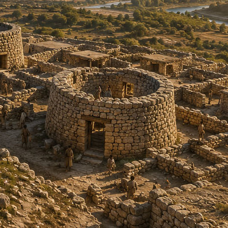
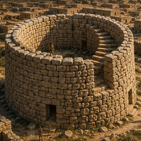
Tell Qaramel brings monumental architecture into the middle of an inhabited settlement. Excavators uncovered a succession of substantial circular stone structures alongside houses, hearths, courtyards, storage features, stone tools, and other evidence of everyday life. The circular constructions are commonly described by the excavators as towers, but their complete purpose is still interpreted rather than known from any surviving written explanation.
Conceptual reconstruction. The illustration emphasizes Tell Qaramel's unusual sequence of circular stone structures and associated settlement. Exact superstructure heights, roofing, and the appearance of the surrounding village are not completely preserved and should not be read from the illustration as measured fact.
PeriodEarly Aceramic / Pre-Pottery Neolithic
Museum ContextPre-Flood Architectural Sequence
Primary MaterialsStone, pebbles, mud, lime
Major DiscoveryFive circular tower phases
Why Tell Qaramel matters: the site preserves more than an isolated monument. Archaeologists exposed a settlement containing domestic structures and a sequence of substantial circular stone constructions interpreted by the excavators as towers. This combination allows us to examine monumental building and ordinary community life within the same archaeological landscape.
Site Profile
Location
Northern Syria, north of Aleppo
Settlement area
Approximately 3.5 hectares reported by the Polish Centre of Mediterranean Archaeology
Excavated monumental sequence
Five circular structures interpreted as successive towers
Domestic architecture
Round and oval houses, some divided into rooms; mud-and-stone construction occurs repeatedly
Flint, ground and pecked stone tools, decorated stone objects, animal bone, other settlement material
Original name
Unknown
Written identification of builders
None
The Circular Towers
Excavation identified five circular tower phases within the settlement sequence. Their dimensions and construction were not identical, demonstrating rebuilding rather than a single frozen architectural plan.
In one well documented pair, the older structure measured approximately 7.5 m in diameter with walls about 2.25 m thick. The younger structure above it measured about 6.6 m in diameter, with walls approximately 0.90 to 1.20 m thick.
The older wall incorporated large boulders, including massive upright stones within the wall core, with mud and pebbles filling intervening spaces.
Architecture Beyond the Towers
Houses and Courtyards
Tell Qaramel also preserves ordinary architecture. Excavators documented oval and round houses made from combinations of mud, pebbles, flat stones, lime-rich material, and timber-supported roofing. Some houses were subdivided into two rooms. Mud-plastered courtyards, hearths, storage pits, benches, platforms, and postholes reveal spaces designed for repeated daily use.
A Settlement Rebuilt Again and Again
Structures repeatedly appear above earlier structures. The excavators describe successive occupational levels in which houses, work areas, hearths, and monumental circular structures were rebuilt or replaced. That vertical sequence is physical evidence for repeated occupation and architectural change, regardless of what absolute calendar age is assigned to it.
Measured Tower Evidence
Feature
Recorded evidence
Museum classification
Number of circular tower phases
Five identified in the excavation record
Observed / excavated
Older documented tower
Approximately 7.5 m diameter; wall about 2.25 m thick
Measured
Younger documented tower
Approximately 6.6 m diameter; wall about 0.90 to 1.20 m thick
Measured
Older wall construction
Pebble-and-mud foundations supporting large boulders; upright boulders used within wall core
Observed
Function as "towers"
Interpretation used by the excavators for the circular monumental structures
Archaeological interpretation
Defensive function
Suggested for some phases but not established for the entire sequence
Hypothesis / interpretation
What Was Found Around Them?
The towers were embedded in a wider settlement containing houses, animal bone, flint, heavy stone tools, hearths, storage areas, and work spaces. One domestic building was approximately 3.5 by 2.4 m and divided into two rooms. Another round house measured about 2.6 m in diameter. Other excavated structures reached approximately 5 m across.
This matters because Tell Qaramel is not simply a mysterious circular monument. It provides an architectural landscape in which monumental and domestic construction can be compared.
Material Oddities and Breadcrumbs
As this collection expands, visitors will encounter other unusual ancient objects and constructions beyond the main architectural exhibits: megalithic chambers and dolmens, carved stone spheres, standing stones, subterranean spaces, quarry scars, polished stone objects, unusual alignments, and artifacts whose original meanings are under study.
These references are included as research breadcrumbs. Their presence does not mean they share one builder, one period, or one explanation. Some deserve exhibits of their own; others are simply invitations to investigate further.
Observed, Interpreted, Unknown
Statement
Status
Tell Qaramel contained repeated circular stone constructions and domestic buildings.
Observed
At least one large circular structure had walls over two meters thick.
Measured
The circular structures should be called towers.
Excavator interpretation
Every tower was defensive.
Not established
The settlement's builders are known by name.
Unknown
The original meaning of the monumental circular structures is fully understood.
Unknown
Curator's assessment: Tell Qaramel broadens the Pre-Flood architecture survey beyond carved pillars and ceremonial-looking enclosures. Here we encounter massive circular construction beside recognizable domestic spaces. The strongest evidence is not a calendar date. It is the surviving architecture itself: repeated rebuilding, thick stone walls, houses, courtyards, hearths, storage features, and a settlement whose monumental structures remain open to interpretation.
Research Record
Source
Contribution
Ryszard F. Mazurowski, Tell Qaramel excavation reports, Polish Archaeology in the Mediterranean
Documents the five circular structures and the excavators' chronological research. This collection records the architectural period without assigning an absolute date.
Polish Centre of Mediterranean Archaeology, University of Warsaw
Mission history, site description, and settlement-scale context.
07Exhibit 07Jericho / Tell es-SultanJericho, West Bank
Jericho / Tell es-Sultan
Jericho presents a layered architectural story unlike any site encountered so far in this collection. Beside the living modern city stands Tell es-Sultan, an archaeological mound containing the remains of many successive communities. Within those deposits are a monumental stone tower, substantial wall, rock-cut ditch, domestic architecture, later fortifications, and evidence of repeated rebuilding. These features belong to different archaeological layers and must not be compressed into a single reconstructed city.
Conceptual reconstruction. The tower, wall, ditch, settlement deposits, and domestic architecture are grounded in excavated evidence. The complete appearance of the settlement at any single moment is not preserved, so the surrounding cityscape in this illustration is interpretive rather than a measured reconstruction.
PeriodNeolithic
Museum ContextPre-Flood Architectural Sequence
Ancient SiteTell es-Sultan
Modern CityJericho remains inhabited today
Jericho Did Not Disappear
Modern Jericho is a living city. The archaeological site discussed in this exhibit is Tell es-Sultan, an oval mound northwest of the present-day city beside the perennial spring of 'Ain es-Sultan. The mound preserves deposits from many successive periods of occupation. UNESCO identifies twenty-nine phases in its archaeological stratigraphy.
This distinction matters. When visitors hear the name "Jericho," several very different things can become blended together: the modern city, the Neolithic settlement, later Bronze Age cities and fortifications, and the Jericho described in the biblical Book of Joshua. They are related by place, but they are not one single archaeological layer.
The Neolithic Monumental Complex
Observed feature
Archaeological record
Stone tower
Monumental stone tower surviving within the Neolithic deposits
Internal access
Passageway and internal staircase preserved within the tower
Wall
Substantial stone wall associated with the early settlement
Ditch
Ditch cut into the bedrock outside the wall system
Water source
The perennial 'Ain es-Sultan spring immediately beside the mound
Settlement
Permanent occupation with domestic and communal architecture
Later architecture
Early and Middle Bronze Age urban and fortification remains occur in other layers
The Stone Tower
The tower is one of the most striking surviving pieces of architecture at Tell es-Sultan. Its internal passage and staircase demonstrate that this was not simply a heap of stone or retaining mass. It was a deliberately constructed architectural space that people could enter and move through.
The structure required quarrying or collecting large quantities of stone, transporting and placing the material, planning the circular mass, and constructing the internal stairway. Whatever its original function, the surviving tower demonstrates coordinated labor and substantial architectural knowledge.
Observed: stone tower, passage and staircase.
Observed: associated wall and bedrock-cut ditch.
Interpreted: the exact purpose of the tower and the defensive role of the system.
Unknown: what its builders called the tower or what meaning they attached to it.
One Place, Many Jerichos
The Archaeological Mound
A tell is created as communities repeatedly occupy, build upon, alter, abandon, destroy, level, and rebuild the same location. Tell es-Sultan therefore does not preserve one frozen city. It preserves a vertical record of different settlements and architectural episodes.
This is why a wall found in one archaeological layer cannot automatically be combined with a tower, house, rampart, or destruction horizon from another layer to create a single reconstructed city.
The Modern City
The name Jericho still belongs to a living community. Ancient Tell es-Sultan lies northwest of present-day Jericho in the Jordan Valley. The adjacent spring continues to function as a water source, linking the landscape occupied today with the landscape that drew communities to this location in antiquity.
For the museum visitor, Jericho therefore offers something unusual: an ancient architectural landscape beside a city whose name and human occupation continue into the present.
Is This the Wall from the Book of Joshua?
We should not identify the Neolithic wall, tower, and ditch shown in this exhibit with the fortifications described in Joshua. The Neolithic monumental structures belong to a much earlier archaeological context within the conventional classification system. Tell es-Sultan also contains later Bronze Age architecture and fortification systems.
The biblical account of Joshua is therefore a separate historical and archaeological question. Arguments about which archaeological phase, if any, should be associated with the biblical conquest must be evaluated using the relevant later settlement layers, pottery, destruction evidence, fortifications, textual chronology, and competing archaeological interpretations. The existence of the early tower does not by itself answer that question.
What Is Actually Preserved?
Evidence
What we can responsibly say
Status
Tell / mound
The site contains many superimposed occupation phases rather than one settlement.
Observed
Stone tower
A monumental Neolithic tower survives in situ.
Observed
Internal staircase
The tower contains an internal passageway and staircase.
Observed
Wall and ditch
A substantial wall and a ditch cut into bedrock formed part of the early monumental landscape.
Observed
Purpose
Fortification, communal organization, water management, symbolism, and other functions have been discussed.
Interpreted / under continued study
Complete city appearance
Excavation does not preserve enough evidence to reproduce every building at one moment with certainty.
Unknown
Biblical Joshua identification
The early Neolithic tower and wall are not automatically the fortifications described in Joshua.
Separate archaeological question
Why Build Here?
The spring of 'Ain es-Sultan is one of the most important physical facts in understanding the site. A dependable water source in the Jordan Valley made this location unusually attractive for repeated settlement. The architecture should therefore be viewed together with the landscape: water, fertile ground, access routes, defensive possibilities, and the surrounding valley.
Beyond the Architecture
Jericho's archaeological record includes more than walls and houses. Finds such as specially treated human skulls and anthropomorphic figures have contributed to interpretations of ritual and social life. As elsewhere in this collection, the objects themselves are evidence; the beliefs or ceremonies reconstructed from them remain interpretations.
A Useful Warning for the Entire Museum
Jericho demonstrates why ancient sites must be examined layer by layer. A dramatic ruin can tempt us to connect every wall, artifact, burial, biblical tradition, megalith, dolmen, stone sphere, subterranean chamber, or destruction deposit into one story. Sometimes evidence supports a relationship. Sometimes it does not. Our approach is to preserve the connection when it is demonstrable, identify it as a hypothesis when it is proposed, and leave it open when the evidence cannot decide.
Research Record
Source
Why it matters here
UNESCO World Heritage Centre, Ancient Jericho / Tell es-Sultan
Site location, living-city distinction, mound character, occupation sequence, spring, monumental wall, ditch and tower, Neolithic and Bronze Age architectural contexts.
ICOMOS evaluation and Tell es-Sultan nomination documentation
Confirms the internal tower staircase, bedrock-cut ditch, preservation of multiple archaeological periods, and distinction between Neolithic and later fortification systems.
Kathleen Kenyon and subsequent Tell es-Sultan excavation publications
Foundational excavation record for the site's stratigraphy, Neolithic architecture and later occupation phases.
08Exhibit 08Nevalı ÇoriŞanlıurfa Province, Southeastern Türkiye
Nevalı Çori
Nevalı Çori combines settlement life with monumental architecture and sculpture. Excavation revealed houses, storage areas, carefully engineered foundations, a specialized building containing T-shaped limestone pillars, anthropomorphic imagery, and a distinctive material culture. Unlike the other sites in this sequence, the original archaeological landscape can no longer be visited: after rescue excavations, the site was submerged beneath the Atatürk Dam reservoir.
Composite reconstruction. The illustration is based on the excavated architectural character of Nevalı Çori but does not reproduce copyrighted excavation photographs or account to reconstruct every wall exactly as it appeared.
PeriodPre-Pottery Neolithic
Museum ContextPre-Flood Architectural Sequence
Site TypeSettlement + special building
Present ConditionOriginal site submerged
A Settlement, Not Just a Monument
Nevalı Çori contained substantial domestic architecture. Long rectangular buildings were constructed on thick stone foundations, with repeated internal divisions and spaces interpreted as living and storage areas. The site therefore gives us something different from a stand-alone monument: ordinary settlement life beside unusual monumental architecture.
Excavation documented several architectural levels, showing that buildings were rebuilt and the settlement changed through repeated occupation.
The Special Building
A semi-subterranean stone structure stood apart from the ordinary houses. Its interior included a broad stone bench, a hard lime-based terrazzo floor, T-shaped limestone pillars set around the perimeter, and two larger freestanding pillars toward the center.
The building was rebuilt in multiple architectural phases. Archaeologists have frequently described it as a cult or special building, but the exact activities that took place inside remain an interpretation rather than a written fact left by its builders.
Architecture and Engineering
Feature
Physical record
Assessment
Residential buildings
Long rectangular buildings with substantial stone foundations and internal divisions
Observed
Underfloor channels
Stone-covered channels occur across or beneath house foundations
Observed; function interpreted
Special building
Semi-subterranean stone architecture with benches, terrazzo flooring, and monumental pillars
Observed
T-shaped pillars
Monolithic limestone pillars occur along walls and as central freestanding elements
Observed
Anthropomorphic details
Arms and hands occur on some pillars and sculptures
Observed
Roof support
Pillars may have supported beams in reconstructed roofing systems
Architectural interpretation
"Temple" or "cult building"
Frequently used interpretation for the special building
Interpretation, not known original name
Sculpture and Human Imagery
Nevalı Çori produced important limestone sculpture, including anthropomorphic pieces and a large sculpted human head. The combination of human imagery, T-shaped pillars, and monumental stone architecture connects the site visually with the wider monumental tradition seen at other southeastern Anatolian sites.
Clay Before Pottery
The phrase Pre-Pottery Neolithic does not mean people did not understand fired clay. Large numbers of small clay objects and figurines were recovered at Nevalı Çori. What is absent from the classification is the established tradition of ordinary ceramic pottery vessels that characterizes later periods.
Selected Archaeological Material
Selected Finds from Nevalı Çori
The illustration below is a museum visualization of documented artifact categories. The HTML catalog beneath it separates the recovered material from interpretations about what those objects meant.
Illustrated artifact guide. These are interpretive redrawings representing documented find categories, not photographs of the original museum objects.
No.
Artifact
Material
Description
Context / Location
Interpretation
Status
1
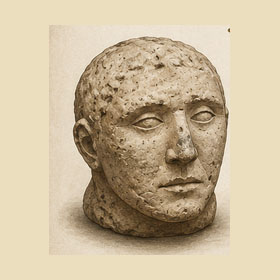
Limestone Human Head
Limestone
Large sculpted human head belonging to Nevalı Çori's monumental sculptural tradition.
Recovered during excavation; associated with the site's special-building and sculptural assemblage.
Human imagery is certain. The identity of the represented figure is unknown.
OBSERVEDArtifact recovered
2
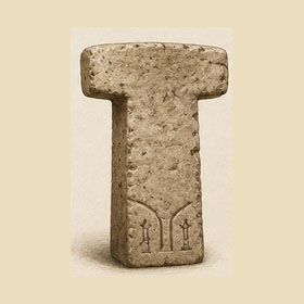
T-Shaped Limestone Pillar
Limestone
Monumental T-shaped architectural element. Some examples carry anthropomorphic arms and hands.
Special-building architecture, including perimeter and freestanding positions.
Likely anthropomorphic in at least some cases; structural and symbolic functions may have overlapped.
OBSERVEDArchitectural element excavated
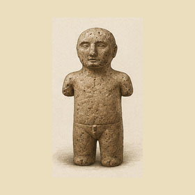
3
Anthropomorphic Sculpture
Limestone
Human or humanlike carved sculpture belonging to the site's extensive figurative imagery.
Monumental-building and settlement deposits.
May represent people, ancestors, supernatural beings, or other concepts. Specific identity is not established.
OBSERVEDSculpture recovered
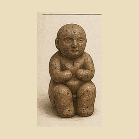
4
Clay Figurines
Fired clay
Hundreds of small modeled clay figures and objects were recovered, including anthropomorphic and zoomorphic forms.
Settlement layers and building deposits.
Possible symbolic, personal, instructional, or ritual functions have been proposed; exact use is unknown.
OBSERVEDArtifacts recovered
5
Worked Stone Containers
Stone
Worked stone containers and related ground-stone material occur within the site's broader material culture.
Settlement contexts.
Likely used for holding or processing materials; specific contents should not be assumed without residue evidence.
OBSERVEDArtifact category represented
6
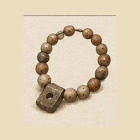
Beads & Ornaments
Worked small objects
Perforated and shaped small finds represent personal-material culture within Neolithic settlement life.
Settlement deposits and associated contexts.
Often interpreted as personal ornamentation. Social meaning cannot be determined from appearance alone.
OBSERVEDArtifact category represented
7
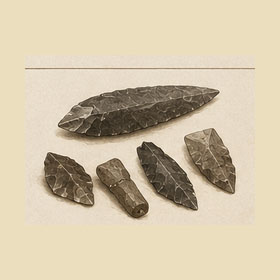
Stone Tools & Points
Flint / chipped stone
Blades, points, and other stone implements formed part of the settlement's tool assemblage.
Recovered throughout settlement deposits.
Different forms were used for cutting, hunting, processing, woodworking, and other tasks; individual use depends on tool context and wear.
OBSERVEDArtifacts recovered
Illustration note
The thumbnails are museum illustrations derived from our selected-finds artwork. They are visual guides rather than photographs or exact facsimiles of individual museum specimens.
09Exhibit 09Çayönü TepesiDiyarbakır Province, Southeastern Türkiye
Çayönü Tepesi
At Çayönü, the architecture itself records repeated experimentation. Successive communities changed how buildings were founded, divided, surfaced, and organized, leaving round structures, grill-plan foundations, channeled buildings, cobble-paved floors, cell-plan buildings, large rooms, and several unusual communal or special structures. Rather than a single monument, Çayönü gives us a long architectural laboratory preserved in the ground.
Architectural reconstruction. This illustration visualizes documented building forms from Çayönü, including grill-plan foundations, the Terrazzo Building, and cell-plan architecture. Roofs, complete wall heights, furnishings, and the appearance of the living settlement are reconstructed because those elements are not completely preserved.
PeriodPre-Pottery Neolithic
Museum ContextPre-Flood Architectural Sequence
Site TypeLong-lived settlement
Key EvidenceChanging architectural plans
Why Çayönü Is Different
Çayönü does not depend upon one spectacular monument. Its importance lies in the sequence of different building traditions preserved at the same settlement. Archaeologists distinguish round buildings, grill-plan buildings, channeled buildings, cobble-paved buildings, cell-plan buildings, and large-room buildings. These names describe physical differences in architecture rather than assigning a calendar date to the structures.
The result is unusually valuable: instead of seeing only a finished architectural form, we can compare repeated changes in how people organized foundations, floors, rooms, open spaces, and specialized buildings.
An Architectural Sequence
Building tradition
What distinguishes it
Evidence status
Round Buildings
Curving or circular building plans associated with the earlier architectural sequence at the settlement.
Observed
Grill-Plan Buildings
Parallel stone foundation walls form grill-like substructures beneath portions of rectangular buildings.
Observed
Channeled Buildings
Longitudinal channels become a defining feature of the building foundations and floor system.
Observed
Cobble-Paved Buildings
Structures incorporate cobbled or pebble-covered surfaces and increasingly substantial rectangular planning.
Observed
Cell-Plan Buildings
Stone foundation walls divide the lower part of buildings into repeated compartments or cells.
Observed
Large-Room Buildings
The architectural sequence later includes plans dominated by larger interior rooms.
Observed
1. Grill-Plan Architecture
The grill-plan buildings are immediately recognizable from above. Parallel stone foundation walls create long narrow spaces beneath parts of the structure. The preserved masonry demonstrates that the builders were not merely outlining a room at ground level. They were deliberately constructing a foundation system before the upper building was completed.
Exactly why this arrangement was chosen continues to be studied. Air circulation, moisture control, raised flooring, structural support, storage, and combinations of these functions have been discussed. The parallel stone foundations themselves are observed; their complete purpose is interpreted.
2. Cell-Plan Architecture
In the cell-plan buildings, substantial stone foundations create multiple rectangular compartments. These lower cells supported an upper occupied level in archaeological reconstructions, demonstrating a more vertically organized building system than a simple one-room ground plan.
The change from grill-like foundations to compartmentalized substructures is one of the clearest examples of architectural experimentation preserved at Çayönü.
Planned Before It Was Built?
A formal architectural study of the Terrazzo Building, a cell-plan building, and a grill-plan building found evidence of repeated geometric relationships and proposed the use of a standardized measuring unit of approximately 0.48 meter. The researchers concluded that at least some Çayönü architecture may have been planned using measurement and geometric principles before construction.
Observed: repeated dimensions, alignments, and geometric relationships in excavated plans. Interpretation: the builders used a formal planning system and standardized unit. Unknown: what the builders called that unit, how measurements were taught, and whether plans were physically drawn before construction.
The Terrazzo Building
A Deliberately Finished Floor
The structure known as the Terrazzo Building differs from ordinary domestic architecture. Its floor was manufactured from crushed stone set into a lime-based matrix and then carefully finished and polished. The surviving surface demonstrates deliberate control of material preparation and finishing rather than an untreated earth floor.
The term terrazzo describes the construction technique. It should not make us imagine a later Roman mosaic floor. Çayönü's surface is its own architectural technology.
Special, Public, Ritual?
Researchers have called the Terrazzo Building and several other unusual Çayönü structures special buildings, public buildings, or in older literature, cult buildings. Those labels reflect the buildings' unusual plans, construction, contents, and separation from ordinary houses.
What the builders themselves called these structures is unknown. A communal or ritual role is plausible, but the architecture does not preserve a written explanation of the activities that occurred inside.
Three Unusual Structures
Structure
Physical evidence
What remains under study
Flagstone Building
Distinctive structure with a floor made from large stone slabs and architectural features unlike ordinary houses.
Its precise social, ceremonial, or communal function.
Skull Building
Human skulls and other disarticulated human remains were recovered from a repeatedly rebuilt special structure.
The exact mortuary procedures, beliefs, ceremonies, and meaning attached to the remains.
Terrazzo Building
Large specialized structure with an intentionally manufactured and polished terrazzo floor.
The precise activities conducted inside and the significance of its unusual finish.
The Skull Building: Evidence Before Interpretation
The name Skull Building comes from the human remains discovered there, including large numbers of disarticulated skulls and other bones. The building was also altered and rebuilt during its use. This is strong physical evidence for unusual treatment of the dead.
It does not tell us by itself exactly what the people believed. Terms such as ancestor veneration, mortuary ritual, ceremonial processing, or other explanations belong in the interpretation column unless supported by additional evidence.
Early Copper Working
Çayönü is also important in discussions of early copper technology. Native copper objects and evidence of deliberate working of copper are part of the site's technological record. The material demonstrates experimentation with a substance very different from ordinary chipped stone.
For this museum, the significant point is technological rather than chronological: the same settlement that preserves changing architectural systems also preserves evidence of experimentation with copper.
Architecture as Evidence
No inscription tells us who designed these buildings. No surviving manual explains the grill foundations. No text identifies the Skull Building or Terrazzo Building by name. Yet the foundations themselves preserve decisions: dimensions were chosen, walls aligned, surfaces prepared, rooms divided, structures replaced, and specialized spaces constructed.
Çayönü therefore gives us exactly the kind of evidence this collection is designed to examine: what people physically built before we decide what their buildings meant.
Observed · Interpreted · Unknown
Statement
Classification
The settlement contains a sequence of markedly different architectural plans.
Observed
Parallel grill foundations, channels, cell foundations, paved surfaces, and large-room plans are preserved archaeologically.
Observed
The Terrazzo Building contains a deliberately manufactured and polished floor.
Observed
The Skull Building contained numerous disarticulated human remains.
Observed
Some buildings served communal or ritual purposes rather than ordinary domestic use.
Interpretation strongly informed by architectural context
A measuring unit near 0.48 m was intentionally used in architectural planning.
Published architectural interpretation
The precise beliefs associated with the Skull Building are known.
Unknown
The original names and intended meanings of the special buildings are known.
Unknown
Curator's Assessment
Çayönü is compelling not because it gives us one impossible object, but because it preserves repeated architectural decision-making. Different communities altered foundation systems, room arrangements, floor technologies, and specialized spaces while continuing to occupy the same settlement. The evidence allows us to watch construction traditions change without requiring us to assign an absolute calendar date to the buildings.
Research Record
Research source
Contribution to this exhibit
Gil Haklay & Avi Gopher, Architectural planning and measuring in the Pre-Pottery Neolithic site of Çayönü, Turkey, Paléorient
Architectural sequence, analysis of grill-plan, cell-plan, and Terrazzo buildings, geometric planning, and proposed standardized measurement.
Wulf Schirmer, Some aspects of building at the aceramic-neolithic settlement of Çayönü Tepesi, World Archaeology
Detailed study of Çayönü building techniques and the exceptional architectural sequence.
Çayönü excavation publications by the Braidwood and Özdoğan research teams
Primary archaeological framework for settlement phases, special buildings, human remains, material culture, and architectural change.
10Exhibit 10Aşıklı HöyükAksaray Province, Central Anatolia, Türkiye
Aşıklı Höyük
Aşıklı Höyük preserves something quieter than a monumental stone enclosure, but no less revealing: continuity. Excavation exposes successive mudbrick buildings, hearths, activity areas, burials beneath floors, and dense traces of everyday life. Again and again, structures were rebuilt in familiar locations. The result is not simply a collection of houses, but an archaeological record of people repeatedly returning to the same built spaces.
Excavation study panel. The exhibit emphasizes surviving archaeological remains rather than presenting a definitive reconstruction of the occupied settlement. Complete wall heights, roofs, entrances, furnishings, and the original appearance of the buildings require reconstruction.
PeriodPre-Pottery Neolithic
Museum ContextPre-Flood Collection
Primary ArchitectureMudbrick / earthen construction
Key EvidenceRepeated rebuilding
The House That Would Not Move
One of the most striking features of Aşıklı Höyük is the persistence of architectural location. Excavators found buildings repeatedly constructed over earlier buildings, often preserving similar spatial arrangements. Walls disappeared and were rebuilt. Floors accumulated. Hearths and domestic features returned. Yet the location of the household could remain surprisingly stable.
The physical sequence is observable in the excavation. Why people maintained that continuity is another question. It may reflect household identity, inherited space, practical building traditions, social memory, or relationships with earlier occupants. Without a surviving written explanation, those possibilities remain interpretations.
What the Excavation Reveals
Evidence
What is physically present
What it may tell us
Mudbrick Buildings
Rectangular earthen architecture preserved in successive building levels.
Construction relied heavily on earth and required repeated maintenance and rebuilding.
Repeated Building Locations
New structures were erected over earlier structures with strong continuity in location and organization.
Household space may have remained important beyond the lifespan of a single building.
Hearths
Fire installations occur within domestic spaces and recur through rebuilding episodes.
Household activities were organized within persistent interior zones.
Burials Beneath Floors
Human burials were placed below floors within buildings.
The dead remained physically incorporated into spaces used by the living; the beliefs behind the practice are unknown.
Obsidian
Worked volcanic glass and manufacturing debris occur extensively at the site.
Obsidian was an important raw material and records skilled stone-working activity.
Sheep and Goat Remains
Animal remains preserve changing patterns of interaction between people and caprines.
Researchers interpret the sequence as evidence for increasingly intensive animal management.
Architecture Built in Earth
Aşıklı Höyük reminds us that monumental stone is not the only architecture capable of preserving sophisticated organization. Much of the settlement was constructed from mudbrick and other earthen materials. Rectangular buildings formed dense groups, with interior spaces organized around recurring domestic activities.
Because earthen architecture erodes dramatically, surviving walls should not be mistaken for their original height. Roof forms, upper walls, doors, ladders, and complete exterior appearances require reconstruction.
How Did People Enter?
Many buildings do not preserve obvious conventional ground-level doorways. This has contributed to archaeological reconstructions proposing entry from above, possibly through roofs.
Observed: preserved plans frequently lack clear ground-level entrances. Interpretation: roof access may have been used. Unknown: the exact form of every entrance, roof, ladder, and circulation route.
Living Above the Dead
Some inhabitants were buried beneath building floors. That is physical archaeological evidence, but its meaning deserves restraint. The practice demonstrates that spaces occupied by the living could also contain the dead. It does not, by itself, tell us whether those individuals were regarded as ancestors, relatives, founders, honored community members, or something else.
Obsidian
Central Anatolia provided access to rich sources of obsidian, and Aşıklı Höyük preserves extensive evidence for working this sharp volcanic glass. Cores, flakes, blades, tools, and manufacturing debris allow researchers to examine how raw material was selected, worked, used, and discarded.
Sheep, Goats, and Settlement Life
Animal remains from successive occupation levels have been used to study changing relationships between people, sheep, and goats. Researchers see evidence for increasingly intensive human management rather than a single sudden change. Keeping animals near a settlement also affected space, waste, movement, food, labor, and daily organization.
Observed · Interpreted · Unknown
Statement
Classification
Successive mudbrick buildings were repeatedly constructed in closely corresponding locations.
Observed
Hearths and domestic features recur within the architectural sequence.
Observed
Human burials occur beneath building floors.
Observed
Worked obsidian and production debris are abundant.
Observed
Sheep and goats were increasingly managed by the inhabitants.
Interpretation supported by zooarchaeological evidence
Buildings were commonly entered through their roofs.
Architectural interpretation
Rebuilding in the same place expressed ancestor veneration.
Possible interpretation, not demonstrated
The beliefs attached to underfloor burial are known.
Unknown
Curator's Assessment
Aşıklı Höyük changes the scale of our investigation. Here the most important evidence is not a towering monolith but repetition: rebuilding, resurfacing, reheating, reusing, burying, and returning. Architecture becomes a record of continuity between generations.
The surviving settlement lets us document that continuity without pretending to know exactly what it meant.
Research Record
Research source
Contribution to this exhibit
Aşıklı Höyük Research Project, Istanbul University
Primary excavation record for architecture, settlement organization, burials, material culture, animal management, and continuing research.
Published architectural studies of Aşıklı Höyük
Documentation of repeated building plans, mudbrick construction, interior organization, hearth placement, and architectural continuity.
Zooarchaeological and chipped-stone studies
Evidence concerning sheep and goat management and obsidian technology.
 Limestone
 T-Shaped
 Anthropomorphic
 Clay
Clay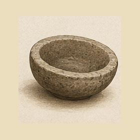 Worked Stone
 Beads &
 Stone Tools