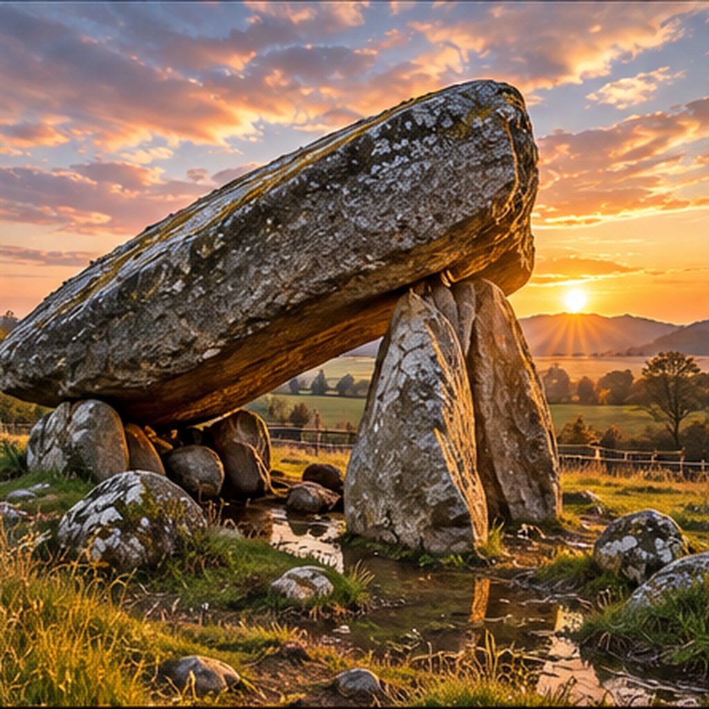
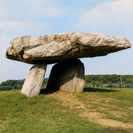
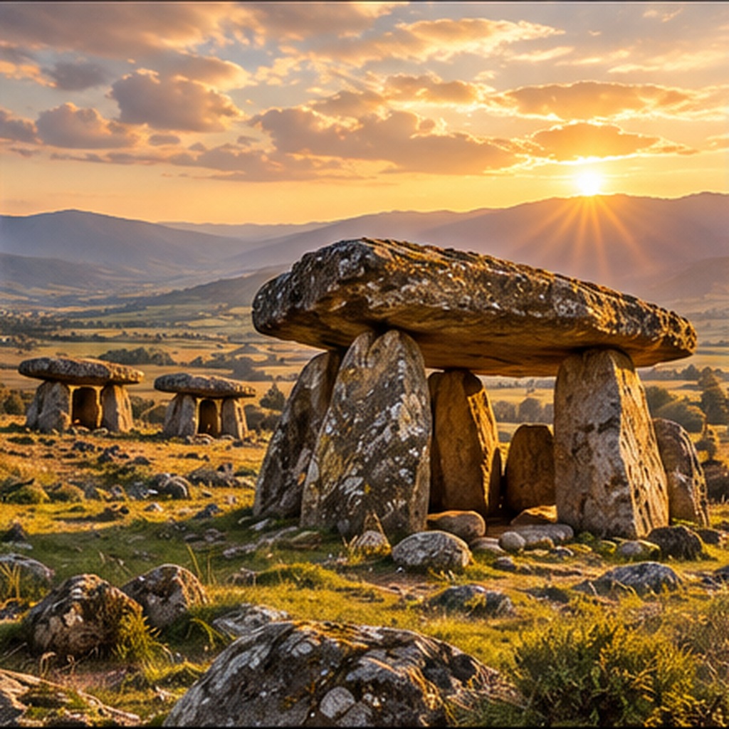
Across Europe, Asia and beyond, prehistoric communities raised immense stone chambers and then covered many of them with earth and stone. Some served the dead. Some were revisited for generations. Some were aligned toward the sun, a mountain, or another feature of the landscape. This collection examines the architecture first, then separates measured evidence from later legend and exploration.
Collection principle: an extraordinary stone does not require an extraordinary explanation. The museum records what was moved, where it came from, how it was positioned, what can be measured, and exactly where the archaeological record stops.
A Message from the Curator
Stone Chambers of a Forgotten World
Scattered across the world are enormous stones that ancient hands somehow lifted from the earth and transformed into monuments. Great capstones rest upon upright supports. Massive chambers disappear beneath earthen coverings. Passageways constructed from blocks weighing many tons still stand after thousands of years. Some of these structures are so immense that a person standing beside them provides the most revealing scale of all. Whatever their purpose, their builders possessed the knowledge, determination, organization, and strength necessary to move stone on a scale that continues to astonish us.
I find these places irresistible because the stones preserve the mystery so well. We can still walk between them, place a hand against their surfaces, and see the tremendous weight that was deliberately positioned by people from a distant age. We know where many of the stones originated. We can measure their dimensions and calculate their weight. We can examine the chambers they formed and the burials and objects discovered within them. Yet the experience of standing before a dolmen inevitably leads to deeper questions. Who conceived these monuments? How many people participated in their construction? What knowledge was passed from one generation of builders to another? Across mountains, coastlines, islands, and continents, the stones remain where their builders left them, inviting us to enter their ancient world.
David PinterCurator, Archoseum
EXPLORE THE COLLECTION
Dolmens & Megalithic Tombs
Open an exhibit below to examine these monumental stone chambers, their archaeological settings, construction, dating, burial traditions, and surviving mysteries.
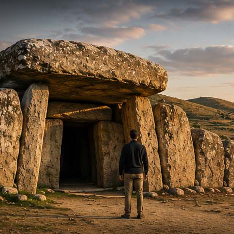
Menga is one of Europe's most extraordinary prehistoric stone monuments. Current scientific dating places its construction around 3800 to 3600 BC. Its chamber was assembled from colossal uprights and capstones, then incorporated into an earthen mound. The largest roof slab has been estimated at roughly 170 tonnes, and the combined weight of the major stones exceeds 800 tonnes. Instead of following the common eastward sunrise orientation seen in many Iberian megaliths, Menga's axis points toward La Peña de los Enamorados, a distinctive mountain on the Antequera horizon.
Interpretive museum illustration. Human scale and the engineering problem are emphasized visually. Exact measurements, chronology, geology and orientation are maintained below as live HTML.
Constructionc. 3800–3600 BC
Interior length24.9 m
Maximum width5.7 m
Largest capstone~170 tonnes
Stone total800+ tonnes
The Monument
A vast lintelled chamber beneath a mound
Menga's internal space measures approximately 24.9 m long, reaches a maximum width of about 5.7 m, and rises from roughly 2.5 m at the entrance to 3.45 m toward the rear. The chamber is formed by twelve uprights on each side, a massive backstone, and five great capstones.
Three large pillars stand along the longitudinal axis beneath the joints of four inner capstones. Their presence is unusual and makes the interior immediately recognizable. Outside the stone chamber, the monument was incorporated into a carefully constructed mound made with alternating stone and compacted earth layers.
Architecture & Scale
Element
Measured / estimated evidence
Why it matters
Interior length
24.9 m
A very large enclosed stone space for fourth-millennium BC Europe.
Maximum width
5.7 m
The chamber widens substantially behind the entrance.
Interior height
About 2.5 m at entrance to 3.45 m at rear
The builders controlled both vertical clearance and the changing chamber profile.
Side uprights
12 on each side
Twenty-four side form the principal walls.
Backstone
1 massive terminal slab
Closes the inner end of the chamber.
Central pillars
3
Aligned with the chamber axis and positioned beneath capstone joints.
Capstones
5
Create the lintelled roof above the chamber.
Largest capstone
Approximately 170 tonnes in current research
Among the largest stones moved in European construction.
Combined major-stone mass
Well over 800 tonnes
Demonstrates the scale of quarrying, transport, preparation and placement involved.
Orientation & Sacred Landscape
Observation
Status
Museum interpretation
Menga's main axis is approximately 45°
Measured
The bearing falls outside the normal range of solstitial sunrise orientations used by many Iberian megaliths.
Axis faces La Peña de los Enamorados
Established
identifies this relationship as one of the monument's defining characteristics.
Matacabras rock-art shelter lies near the line of orientation
Archaeologically significant
Earlier ritual activity at La Peña strengthens the interpretation that the mountain was culturally important.
Exact ritual meaning of the orientation
Unknown
No written account from Menga's builders survives.
Stone Provenance
The quarry was close, but the problem was enormous
Modern geological analysis indicates that the stones were obtained from sources close to Menga rather than transported from many kilometers away. Most were sourced from the nearby El Torcal de Antequera region and local outcrops, with the study emphasizing careful selection of stone properties suited to construction.
The short transport distance does not make the task trivial. Moving a slab approaching 170 tonnes across uneven ground, controlling it on a slope, erecting supporting stones and placing a capstone safely above them remain major engineering operations.
The Engineering Problem
The stones were quarried. They arrived at the building site. Uprights were erected. Capstones were raised and precisely positioned. Those facts are physically present in the monument. The exact sequence of ramps, leverage, earthworks, timber, ropes, sledges, temporary supports, workforce organization, and lifting procedures used for the heaviest stones has not survived as a written technical record. For that reason this exhibit does not depict one exploratory transport method as though it were established fact.
Scientific Chronology
Dating evidence
Result
Meaning
Radiocarbon program
Multiple Late Neolithic samples
Provides a statistical framework for construction rather than relying on typological comparison alone.
Bayesian models
Broad construction boundaries approximately 3900–3500 BC
Defines the wider probability envelope.
OSL dates from Pillar 3 socket sediments
Consistent with radiocarbon models
Independent dating method supports the construction sequence.
Best current synthesis
Approximately 3800–3600 BC
Current multimethod research narrows the probable construction interval.
Later activity
Neolithic through much later periods
Menga had a long biography after its initial construction.
The Deep Well
An unusual feature inside the monument
Menga contains a deep well within the chamber area. specifically notes the well as part of the monument's intimate relationship with the natural landscape. Its exact date and original role have been under continued study, so the museum treats the well as an important physical feature without assigning a single exploratory purpose.
Evidence Profile
Monumental engineeringEstablished
The surviving stones, dimensions, supports and mound construction directly document large-scale planning and execution.
Mountain orientationEstablished
Menga is deliberately oriented toward La Peña de los Enamorados rather than the canonical sunrise direction.
Exact construction machineryUnknown
The archaeological record constrains possible methods but does not preserve a complete technical manual.
Giant Association
Why Menga Opens This Collection
The scale forces the right question
Menga does not need a giant legend to be extraordinary. The physical monument already presents a serious engineering problem. By beginning with a site whose archaeology is unusually rich, the Dolmens collection establishes its standard: measure first, identify provenance, document orientation, examine chronology, and only then consider broader interpretations.
Primary Research Record
Sources behind the exhibit
World Heritage Centre, Antequera Dolmens Site. Official description of the Menga, Viera and El Romeral monuments, their monumental engineering and their exceptional relationships with La Peña de los Enamorados and El Torcal.
García Sanjuán et al., 2023, Quaternary Research. Multimethod chronological study combining radiocarbon, OSL and other evidence, placing Menga's construction around 3800 to 3600 BC and documenting its architectural dimensions.
Lozano Rodríguez et al., 2023, Scientific Reports. Geological provenance study of Menga's stones, including the enormous mass of its largest capstone and the engineering implications of the selected stone sources.
02Exhibit 02Pingmaebawi DolmenHwasun, Jeollanam-do, South Korea
Pingmaebawi Dolmen
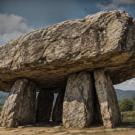
On a high point within the Pingmaebawi district of the Hwasun Dolmen Site stands an exceptionally large dolmen. The official Hwasun World Heritage site describes its capstone as about 7 meters long, 4 meters high and more than 200 tons. Its underside was worked, five upright stones stand beneath it, and an open space survives below. The same official heritage record also preserves local traditions connecting Pingmaebawi with Mago Grandma, Janggunbawi and acts of extraordinary strength. Archaeology and folklore are therefore unusually easy to place side by side here without confusing one for the other.
Interpretive museum illustration. The 5 ft 6 in human figure provides scale. The traditional panel represents recorded Hwasun folklore and is not presented as a historical reconstruction.
District133 dolmens
Capstone lengthAbout 7 m
Capstone heightAbout 4 m
Estimated mass200+ tons
Upright stones5
The Monument
A 200-ton stone above an open space
Pingmaebawi is the largest dolmen in its named district. According to the official Hwasun Dolmen Site, its super-sized capstone measures approximately 7 m in length and 4 m in height and is estimated to weigh more than 200 tons. The lower face of the capstone was polished or worked. Beneath it are five upright stones with open space arranged below the capstone.
The monument belongs to a much larger archaeological landscape. The Pingmaebawi district contains 133 dolmens, while the official Hwasun inventory lists 596 dolmens across six districts and excavation areas extending for roughly 5 km through the Bogeomjae valley.
Monument Record
Feature
Recorded evidence
Evidence status
Location
Pingmaebawi district, Hwasun County, Jeollanam-do, Republic of Korea
Established
Setting
High ground in the Pingmaebawi district along the Bogeomjae landscape
Established
Capstone length
Approximately 7 m
Official site measurement
Capstone height
Approximately 4 m
Official site measurement
Capstone mass
More than 200 tons, estimated
Official site estimate
Support system
Five upright stones
Observed / recorded
Underside
Lower surface described as polished
Recorded
Upper surface
An oval hole about 40 cm in diameter is recorded
Recorded feature
Historic inscription
An inscription dated 1929 survives on the capstone
Later historical addition
The Archaeological Landscape
Area
Dolmens recorded
What it contributes
Gwebawi district
47
Part of the continuous Hwasun concentration.
Gwancheongbawi district
190
Largest district count in the official Hwasun inventory.
Dalbawi district
40
Connects the sequence across the Bogeomjae valley.
Pingmaebawi district
133
Contains Pingmaebawi itself.
Gamtaebawi district
140
Continues toward the Daesin-ri excavation area.
Daesin-ri excavation area
46
Provides excavated burial chambers, artifacts and dating evidence.
Official Hwasun total
596
Shows that Pingmaebawi belongs to a dense monumental complex rather than an isolated construction.
Excavation & Dating Context
Nearby excavations give the monument cultural context
Excavation at Daesin-ri began in 1999. Surveys examined dozens of dolmens and recovered different forms of burial chambers together with burnished red pottery, spindle-related material, fragments of stone daggers and stone arrowheads. The official Hwasun site reports charcoal and pottery dates that place excavated dolmen activity in the first millennium BC.
This dating evidence is important context for the Hwasun complex, but it should not automatically be treated as a direct radiocarbon date for the Pingmaebawi capstone itself.
Quarry & Engineering Evidence
Hwasun preserves part of the engineering story
emphasizes that identifiable stone outcrops and quarries survive at Hwasun. Excavation and survey work has also reported artificially worked stone areas and traces interpreted as related to the transportation of upright stones and maintenance of dolmen graves.
That gives Hwasun unusually valuable evidence for studying quarrying and monument construction. It does not, however, provide a complete step-by-step record showing exactly how Pingmaebawi's 200-plus-ton capstone was transported, controlled and raised into its final position.
The 200-Ton Problem
The physical facts are simple and demanding: an enormous stone was selected, separated from its source, moved to the monument, controlled during placement and supported above an intentionally arranged space. The surviving monument proves that those operations were accomplished. The exact historical sequence used to accomplish them is not fully preserved.
The Recorded Tradition
Tradition
What the official Hwasun record says
Museum classification
Mago Grandma
Mago carried stones in her skirt toward Unju. In versions of the story, the stones fell when her skirt tore or were discarded after a rooster announced dawn.
Recorded local folklore
Extraordinary strength
The Pingmaebawi name is associated in the official account with the stone having been picked up and thrown.
Recorded tradition, not archaeological fact
Janggunbawi
Pingmaebawi was also called Janggunbawi. A tradition remembered a wooden box beneath the stone containing a commander's clothing.
Recorded local folklore
Stone-throwing custom
Stories describe people attempting to throw a small stone into the hole on top of Pingmaebawi, with success linked in different versions to marriage or the sex of a future child.
Folk custom / legend
Historical identification of a giant builder
No excavated inscription or contemporary construction record identifies a giant builder.
Not established
Mago
Why the folklore matters
The important point is not that a folktale proves who constructed the dolmen. It does not. The important point is that the community surrounding a genuine monument of exceptional mass preserved stories in which extraordinary strength explains or interacts with the stone.
That makes the tradition a legitimate cultural artifact in its own right. It can be documented, dated where possible and compared with traditions attached to other megalithic sites.
Giant Association Assessment
Evidence
Strength
Assessment
200+ ton capstone
Strong physical evidence
Demonstrates exceptional megalithic engineering, but stone size alone cannot identify the builders' stature.
Five supporting uprights and worked underside
Strong physical evidence
Supports deliberate architectural construction and preparation.
Quarries within the Hwasun landscape
Strong archaeological evidence
Helps reconstruct stone procurement and provides context for monument construction.
Mago Grandma / thrown-stone stories
Documented folklore
Authentic evidence for a local tradition of extraordinary strength associated with the stone, not proof of a giant population.
Janggunbawi tradition
Documented folklore
Preserves another strand of cultural memory attached to Pingmaebawi.
Oversized human remains from Pingmaebawi
No established evidence located
No giant skeletal evidence should be accounted for this exhibit without a specific documented find.
Giant builders
Unproven
The exhibit records the association without converting folklore into archaeology.
Evidence Summary
MonumentEstablished
Pingmaebawi is a genuine prehistoric dolmen within the Hwasun World Heritage landscape.
Exceptional massEstablished estimate
The official site gives the capstone as more than 200 tons.
Mago and Janggunbawi traditions are preserved by the official Hwasun heritage site.
Curator's assessment: Pingmaebawi is not evidence that a race of giants built Korean dolmens. It is something more precise and more defensible: an exceptionally massive prehistoric monument for which the local cultural record preserves stories of extraordinary strength. The archaeology and the tradition are both real evidence, but they are evidence of different things.
03Exhibit 03Dolmens of the Western CaucasusKrasnodar Krai and the Black Sea Coast, Russia
Dolmens of the Western Caucasus
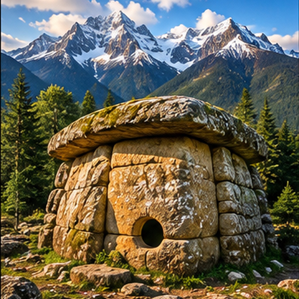
Across the Western Caucasus, prehistoric communities created a remarkable megalithic tradition using several distinct forms of stone chamber. Russian archaeological research places the dolmen culture broadly from the late 4th through the 2nd millennium BC. This exhibit compares three visually different monuments within that wider tradition: the Shapsugskiy Dolmen, dolmens of the Zhane River valley, and the extraordinary rock-cut Volkonsky Dolmen.
Interpretive museum comparison of three Western Caucasus dolmen forms. Scale references are included to help visitors compare the structures. Architectural details should be read together with the documented record below.
Regional traditionLate 4th to 2nd millennium BC
RegionWestern Caucasus
ShapsugskiySlab-built monument
ZhaneMultiple dolmen forms
VolkonskyMonolithic rock-cut chamber
A Regional Tradition
Not one monument type
Western Caucasus dolmens are often recognized by their chamber-like form and small portal opening, but they were not all constructed in the same way. Archaeological classifications distinguish slab-built, composite, trough-shaped and monolithic forms, with intermediate variants as well.
This diversity is one reason the three monuments in this exhibit belong together. Their differences show that the builders were working within a shared regional architectural tradition while solving the problem of creating enclosed stone chambers in markedly different ways.
The Three Monuments
Monument
Location
Architectural character
What makes it important
Shapsugskiy Dolmen
Near stanitsa Shapsugskaya, Abinsk District, Krasnodar Krai
Large slab-built Caucasian dolmen associated with the Shapsugskaya megalithic landscape
Provides a strong example of the monumental slab tradition and belongs to a federally protected archaeological complex.
Zhane River Dolmens
Zhane River valley near Vozrozhdenie, Gelendzhik area
A group containing both composite and slab-built forms
The valley preserves several dolmens in close proximity, allowing architectural differences to be compared within one landscape.
Volkonsky Dolmen
Lazarevsky District, Sochi, Krasnodar Krai
Full-size monolithic chamber carved into a sandstone mass
One of the most unusual Caucasian solutions: instead of assembling the chamber from slabs, the interior was hollowed from the rock itself.
Shapsugskiy Dolmen
The large Shapsugskaya monument
The Shapsugskiy Dolmen stands in the archaeological landscape near stanitsa Shapsugskaya in the Abinsk District of Krasnodar Krai. The surrounding area contains a recognized dolmen and burial complex. Russian heritage documentation identifies the Bolshoy Shapsugskiy burial ground ensemble as a federal cultural-heritage property and places the protected complex near the right bank of the Adegoi River close to its junction with the Skabido.
The monument is valuable for this exhibit because its architecture differs visibly from the composite Zhane example and dramatically from Volkonsky's rock-cut chamber.
Zhane River Valley
A landscape of multiple dolmens
The Zhane River lies southeast of Gelendzhik. Archaeological monuments occur along the valley, including dolmens and much later Adyghe burial mounds. Published descriptions identify a principal group of three dolmens containing two round composite structures and one slab-built structure. Another group farther upstream includes a surviving slab dolmen together with damaged slab and false-portal examples.
That mixture is especially useful because it demonstrates that a single valley could preserve several architectural solutions rather than one standardized design.
Volkonsky Dolmen
A chamber hollowed from living rock
Volkonsky is the architectural outlier of the group. Sochi visitor and heritage information describes it as the surviving full-size monolithic dolmen of the Caucasus. The chamber is carved into an irregular sandstone mass rather than assembled conventionally from separate wall slabs.
The internal chamber is approximately 1.5 m high in official Sochi visitor information. The entrance is small, the chamber has a domed interior form, and a depression cut into the floor near the entrance has been interpreted as a possible drain. The original stone plug that closed the entrance has not survived.
Architecture Comparison
Feature
Shapsugskiy
Zhane River group
Volkonsky
Regional tradition
Western Caucasus dolmen culture
Western Caucasus dolmen culture
Western Caucasus dolmen culture
Primary construction concept
Large fitted stone elements / slab tradition
Includes composite and slab-built examples
Chamber hollowed into sandstone mass
Portal concept
Characteristic entrance opening
Portal openings occur in several architectural variants
Small opening leading into carved chamber
Separate capstone
Yes, in slab-built form
Varies with monument type
No conventional separate chamber capstone required
Stoneworking challenge
Quarrying, shaping, moving and fitting large elements
Shaping and assembling multiple components
Excavating a chamber from a large sandstone body
Individual precise construction date
Not established here
Not established for the illustrated group here
Not established here
How Caucasus Dolmens Were Built
Archaeological type
Construction principle
Evidence value
Slab-built
Walls, roof and sometimes floor formed from separate large stone slabs. Grooves and carefully fitted joints occur in developed examples.
Demonstrates planning, quarrying, transport and precision fitting.
Composite
One or more walls constructed from multiple smaller stones or plates.
Shows that builders could create the same chamber concept through modular masonry.
Trough-shaped
A chamber hollowed into a large block, generally combined with a separate covering element.
Represents a transition toward carving the monument from the rock itself.
Monolithic
The chamber is cut substantially or entirely into a single rock mass.
Volkonsky demonstrates the extreme form of subtractive construction.
The Engineering Question
The Western Caucasus monuments do not present one engineering problem. They present several. Slab-built dolmens required large stones to be obtained, shaped, transported and fitted. Composite structures required carefully planned masonry. Monolithic examples required a chamber to be excavated from solid rock through a relatively small architectural opening. The surviving monuments establish that these operations were achieved. Where the archaeological record does not preserve a complete construction sequence, the museum should not convert a modern reconstruction into a statement of fact.
Chronology & Cultural Context
Evidence
Date / range
What it establishes
Western Caucasus dolmen culture, Russian Academy of Sciences overview
Late 4th to 2nd millennium BC
Broad chronological framework for the regional megalithic tradition.
Shepsi radiocarbon evidence
Classic portal form by ca. 3250 BC
Secure evidence that the recognizable trapezoidal port-hole form existed very early in the tradition.
Shepsi cultural relationship
Contemporary with Novosvobodnaya-type Maikop contexts
Places early dolmen architecture within a wider Early Bronze Age cultural landscape.
Bolshoy Shapsugskiy protected complex
2nd millennium BC in current heritage designation
Provides official chronological attribution for the protected Shapsugskaya archaeological ensemble.
Individual Zhane and Volkonsky monuments
Within the regional prehistoric dolmen tradition
Precise dates should not be asserted without monument-specific evidence.
Burial, Ritual & Use
Stone chambers associated with the dead
Archaeological research treats Western Caucasus dolmens principally as funerary monuments. Human remains and grave assemblages from excavated dolmens establish burial use. At Shepsi, for example, excavators documented preserved lower burials and associated material while obtaining radiocarbon samples.
The monuments were not necessarily single-use graves. Collective burial, reopening, repeated visitation and ritual activity are all relevant to interpreting the broader dolmen tradition.
What We Can Say About the Builders
Question
Current evidence
Museum conclusion
Were the three monuments made within the same broad tradition?
Architecture, geography and chronology place them within the Western Caucasus dolmen phenomenon.
Yes, broadly.
Were they made by one single tribe?
The tradition spans a large area and many centuries.
Not established. Related or interacting communities is safer than a single tribe.
Were they burial monuments?
Excavated Caucasus dolmens contain human burials and associated archaeological material.
Strongly supported.
Do all three use the same building technique?
The monuments represent different architectural solutions.
No.
Does their engineering require unknown technology?
The monuments demonstrate sophisticated prehistoric stoneworking, but no recovered artifact establishes a lost high-technology system.
Not demonstrated.
Is there archaeological evidence for giant builders?
No securely documented oversized human remains tied to these three monuments were located in the sources used for this exhibit.
No established evidence.
Giant & Folklore Association
An important reversal
Unlike Pingmaebawi, where an official heritage record preserves stories of extraordinary strength, the Western Caucasus dolmens do not currently give us comparably strong site-specific evidence for a race of giant builders. Caucasus dolmens accumulated later folklore, but some traditions actually move in the opposite direction and associate the chambers with unusually small or supernatural inhabitants.
That is worth preserving because this collection is an evidence archive, not a collection in which every monument must support the same conclusion.
Evidence Assessment
Regional archaeologyEstablished
A large and diverse megalithic tradition occupied the Western Caucasus for many centuries.
The evidence currently supports prehistoric megalithic builders, not a documented population of unusually large humans.
Curator's assessment: The Western Caucasus dolmens belong in this collection because they broaden the comparison. Shapsugskiy, Zhane and Volkonsky show that related prehistoric communities could express the same chamber-and-portal tradition through very different engineering solutions. The archaeology is substantial. The giant association is not. That distinction is part of the evidence.
Research Notes
Source family
Contribution to this exhibit
Institute of Archaeology, Russian Academy of Sciences
Regional chronology, research history and archaeological framework for the Western Caucasus dolmen culture.
Trifonov et al., Radiocarbon 56(2), 2014
Radiocarbon chronology for Shepsi and evidence for the classic portal-dolmen form by ca. 3250 BC.
V. I. Markovin, Western Caucasus dolmen studies
Architectural description and classification of slab-built, composite, trough-shaped and monolithic forms.
Krasnodar Krai cultural-heritage documentation
Protected status, location and official chronology of the Bolshoy Shapsugskiy archaeological ensemble.
Sochi visitor / heritage documentation
Description of Volkonsky as a surviving full-size monolithic dolmen and details of its carved chamber.
Gelendzhik regional documentation
Location and surviving dolmen concentrations in the Zhane River valley.
04Exhibit 04Coddu Vecchiu: Tomb of the GiantsArzachena, Gallura, Sardinia, Italy
Coddu Vecchiu: Tomb of the Giants
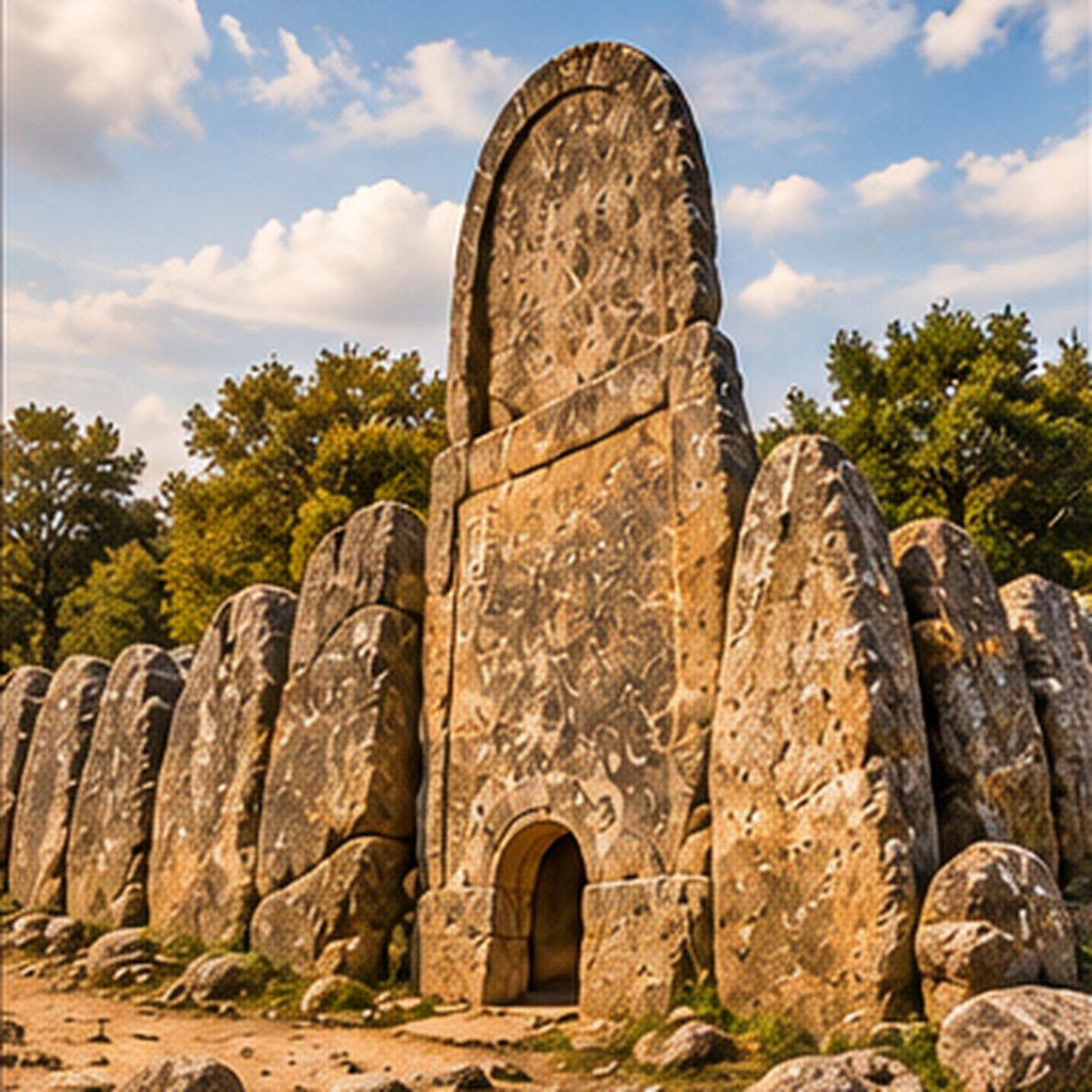
Coddu Vecchiu, also called Coddu 'Ecchju or Capichera, is one of Sardinia's best documented Tombe di Giganti, or "Tombs of the Giants." The name belongs to Sardinian popular tradition, while archaeology identifies the monument as a collective Bronze Age burial place. Coddu Vecchiu is especially valuable because excavation revealed two major building phases: an earlier gallery tomb followed by a monumental transformation that added the great semicircular exedra and Sardinia's largest known curved central stele of its type.
Interpretive museum illustration. The human silhouette is 5 ft 6 in (167 cm) for scale. The central stele is approximately 4.04 m (13.25 ft) high.
Central stele4.04 m / 13.25 ft
Gallery tomb10.50 m long
Funerary corridor9.00 m long
First phaseEarly Bronze Age
Excavated1966 · Editta Castaldi
The Monument
A tomb built twice
Coddu Vecchiu was not created in a single operation. The surviving monument incorporates an older gallery tomb, or allée couverte, that was later monumentalized. The earlier burial structure is approximately 10.50 m long and 3.50 to 4.00 m wide. Inside it is a narrow rectangular funerary corridor approximately 9.00 m long and 1.05 to 1.10 m wide.
During a later phase, builders added the sweeping semicircular exedra to the front. Upright granite slabs decrease in height away from the center, directing attention toward the enormous central stele.
Measured Architectural Record
Feature
Recorded measurement / description
Evidence status
Overall gallery tomb
10.50 m long; approximately 3.50 to 4.00 m wide
Official archaeological record
Funerary corridor
9.00 m long; approximately 1.05 to 1.10 m wide
Official archaeological record
Central stele height
4.04 m / 13.25 ft
Official archaeological record
Central stele width
Approximately 1.90 m / 6.23 ft
Official archaeological record
Doorway height
0.67 m / 2.20 ft
Official archaeological record
Doorway width
0.45 m / 1.48 ft
Official archaeological record
Orientation
East to west axis; entrance to the east
Recorded
Primary stone
Local granite
Observed / recorded
The Scale of the Stele
The central stele is approximately 2.42 times the height of a 5 ft 6 in person. At 4.04 m high, it is the largest curved stele of this type so far identified in Sardinia according to the regional archaeological authority. Its size is visually dramatic, but its importance is architectural as well: it forms the focal point of the exedra and contains the small arched doorway into the funerary passage.
Two Construction Phases
Phase
Archaeological interpretation
Dating
What changed
Phase I
Earlier gallery tomb / allée couverte associated with the Bonnanaro cultural horizon
Early Bronze Age. Current regional documentation places the phase broadly around the early 2nd millennium BC.
A long enclosed funerary corridor was constructed for collective burial.
Phase II
Transformation into the monumental Tomb of the Giants form
Initial Middle Bronze Age
The semicircular exedra, monumental orthostats and great central stele were added to the earlier tomb.
Dating note: Sardinian public archaeological pages do not always use identical absolute year ranges for the Early and Middle Bronze Age phases. The secure point is the sequence: an older Bonnanaro-period gallery tomb was later monumentalized during the Middle Bronze Age. The museum therefore preserves the archaeological phase relationship rather than pretending that one narrow calendar range is universally settled.
How the Monument Was Built
The burial corridor
The interior corridor uses large basal slabs set upright, while the exterior employs blocks arranged in courses with a slight inward projection. Large stone slabs formed the flat roof. The paved floor follows the natural slope of the terrain, although part of that paving was damaged by illicit excavations.
This is substantial stone architecture, but the archaeological description does not require a hypothetical lost technology. It demonstrates organized quarrying, transport, stone selection, fitting and construction using local granite.
The Central Stele
Two enormous granite elements
The famous curved stele is formed from two superimposed stone elements. Both portions carry a flat relief frame. The upper element creates the rounded crown, while the lower element contains the entrance opening.
The doorway is surprisingly small compared with the monument around it: only about 67 cm high and 45 cm wide. That contrast between the monumental façade and restricted opening is one of Coddu Vecchiu's most striking architectural characteristics.
Excavation History
Event
Record
Importance
Pre-modern disturbance
Part of the paved floor was damaged by clandestine excavation.
Some original archaeological context was lost before controlled study.
1966 excavation
Excavated by archaeologist Editta Castaldi.
Provided the principal modern archaeological documentation of the monument and its material sequence.
1969 publication
Castaldi published extensive work on Giants' Tombs in the Sassari region in Origini III.
Placed Coddu Vecchiu within a broader comparative archaeological framework.
Modern restoration
The monument was restored after excavation and study.
Visitors today see a conserved archaeological monument rather than an untouched prehistoric ruin.
Artifacts & Ritual Evidence
Objects left with the dead
Excavation recovered ceramic material including pans, bowls and pots. Regional archaeological interpretation connects these objects with funerary offerings and ceremonies conducted in honor of ancestors, particularly in the exedra.
The artifacts also helped archaeologists distinguish the earlier Bonnanaro phase from the later monumental restructuring.
Why "Tombs of the Giants"?
A real traditional name
The term Tombe di Giganti is not a label invented by modern alternative-history writers. Sardinia's official cultural authority explicitly identifies "Tombs of the Giants" as a name assigned to these Nuragic funerary monuments by popular tradition.
That makes the name itself legitimate evidence for Sardinian cultural memory. What it does not tell us by itself is when the tradition began or whether it preserves literal knowledge of the people originally buried inside.
The Giant Bones Question
Question
What we currently have
Assessment
Were human remains associated with Sardinian Giants' Tombs?
Yes. The monument class is archaeologically identified as collective funerary architecture.
Established
Was Coddu Vecchiu excavated professionally?
Yes. Editta Castaldi excavated it in 1966.
Established
Is the name "Tombs of the Giants" authentic Sardinian tradition?
Yes. The regional cultural authority explicitly attributes the name to popular tradition.
Established cultural tradition
Does the 10.5 m tomb length represent the stature of one body?
No. The chamber belongs to a collective burial monument.
Contradicted by archaeological interpretation
Has a 7 ft, 8 ft or larger skeleton from Coddu Vecchiu been verified in the archaeological documentation reviewed for this exhibit?
No securely documented example has been established.
Not established
Do internet stories of Sardinian giant bones prove unusually large humans were buried here?
Stories without excavation context, measurements, photographs, specimen numbers or surviving remains cannot establish stature.
Unverified unless individually documented
What Would Count as Evidence of a Giant Burial?
For this museum, a convincing account would need more than the traditional name of the tomb. Strong evidence would include an excavation record tied to a specific burial, identifiable skeletal elements, osteological measurements, an estimated living stature, photographs or drawings made during excavation, the name of the excavator, and ideally a surviving specimen or museum accession number. Until such evidence is located, Coddu Vecchiu's giant association belongs in the category of documented tradition, not documented giant anatomy.
Human Scale Comparison
Reference
Height
Relationship to central stele
Illustration human silhouette
5 ft 6 in / 1.67 m
About 41% of the stele's height
6 ft person
1.83 m
About 45% of the stele's height
Coddu Vecchiu central stele
13.25 ft / 4.04 m
Approximately 2.42 times the height of the 5 ft 6 in reference figure
Coddu Vecchiu in the Wider Landscape
Site / feature
Relationship
Why it matters
La Prisgiona
Major Nuragic settlement approximately 1 km away
Coddu Vecchiu is considered part of the associated funerary landscape.
Li Lolghi
Another monumental Giants' Tomb in the Arzachena archaeological landscape
Shows that Coddu Vecchiu was not an isolated funerary experiment.
Moru
Another example in the region of an earlier allée couverte transformed into a Giants' Tomb
Supports the architectural sequence seen at Coddu Vecchiu.
Li Muri
Much earlier necropolis dating to the late 4th millennium BC
Demonstrates the deep prehistoric funerary history of the Arzachena region.
Nuragic Sardinia
Hundreds of Tombs of the Giants occur across the island
Places the monument within an island-wide funerary tradition rather than an isolated anomaly.
Evidence Assessment
ArchaeologyExceptionally strong
Excavation, architecture, artifacts, measurements and construction phases are documented.
Giant traditionAuthentic cultural evidence
The monument belongs to a class genuinely known through popular tradition as the Tombs of the Giants.
Giant skeletal evidenceNot established
No verified giant-sized individual from Coddu Vecchiu has yet been identified in the documentation reviewed.
Curator's assessment: Coddu Vecchiu gives us exactly the kind of case this collection needs. The monument is real, enormous and professionally excavated. The traditional giant association is also real. Yet those two facts do not automatically produce archaeological evidence for giant people. For now, Coddu Vecchiu preserves a powerful intersection of monumental Bronze Age architecture, collective burial and authentic Sardinian giant tradition. The search for measurable oversized human remains remains open.
Primary Research Trail
Source
What it contributes
Regione Autonoma della Sardegna, SardegnaCultura: Coddu 'Ecchju
Official measurements, orientation, architectural description, construction phases, excavation history, artifacts and bibliography.
Regione Autonoma della Sardegna: Tombs of the Giants overview
Collective burial interpretation, monument form and confirmation that the name "Tombs of the Giants" derives from popular tradition.
Editta Castaldi, Tombe di giganti nel Sassarese, Origini III (1969)
Foundational publication following the 1966 excavation and comparative study of the monument class.
La Prisgiona archaeological documentation
Places Coddu Vecchiu within the wider settlement and funerary landscape of Capichera.
05Exhibit 05Brownshill DolmenKernanstown, County Carlow, Ireland
Brownshill Dolmen: The Hundred-Ton Portal Tomb
Brownshill Dolmen, also known as Browneshill Dolmen and Kernanstown Cromlech, is one of Ireland's most imposing Neolithic portal tombs. Its defining feature is an enormous granite capstone measuring approximately 6.1 m by 4.7 m by 2 m and officially estimated at more than 100 tonnes. The monument is particularly important to this collection for another reason: despite its scale and fame, Brownshill has never been archaeologically excavated. Its chamber contents therefore remain unknown.
Interpretive museum illustration based on documented views of Brownshill. The monument's enormous granite capstone dominates the surviving structure. Human scale is included for visual comparison.
Capstone length6.1 m / 20 ft
Capstone width4.7 m / 15.4 ft
Max. thicknessApprox. 2 m / 6.6 ft
Official weight estimate100+ tonnes
Excavated?No
The Monument
A massive granite roof stone
Brownshill stands approximately 3 km east of Carlow town. Ireland's Office of Public Works classifies it as a portal tomb, a Neolithic monument type characterized by a chamber fronted by two tall portal stones and covered by a large capstone.
At Brownshill, the granite capstone rests on two portal stones, a door stone and a flat slab. It slopes downward toward the west, where the rear portion approaches or rests close to lower supporting stonework.
Measured Record
Feature
Documented figure
Museum note
Capstone length
Approx. 6.1 m / 20.0 ft
Official Heritage Ireland measurement
Capstone width
Approx. 4.7 m / 15.4 ft
Official Heritage Ireland measurement
Maximum capstone thickness
Approx. 2 m / 6.6 ft
Official Heritage Ireland measurement
Capstone mass
More than 100 tonnes
Official OPW wording; some local sources publish higher estimates
Stone
Granite
Documented
Monument class
Portal tomb
Archaeological classification
Period
Neolithic
Approximately 4,900 to 5,500 years old in current Heritage Ireland interpretation
Excavation status
Never excavated
Critical evidence limitation
The Engineering Problem
A granite block more than 6 m long and weighing in excess of 100 tonnes was positioned so that a chamber remained beneath it. Whatever sequence the builders used, the finished monument demonstrates control of a very large irregular stone mass and deliberate placement relative to the portal supports. Brownshill itself has not yielded an excavated construction sequence, so proposed ramps, rollers, levers, packing stones or earthen embankments should be presented as reconstruction hypotheses rather than observed facts.
How a Portal Tomb Works
Architectural element
Function
Brownshill
Portal stones
Tall uprights defining the entrance to the chamber
Two prominent portal stones survive beneath the capstone
Door stone
Stone associated with closure or definition of the entrance
Present between the portal arrangement
Capstone
Large stone covering the chamber
Exceptionally massive granite slab, 100+ tonnes
Chamber
Interior space associated by comparison with funerary and ceremonial activity
Never excavated at Brownshill
Mound or cairn
Many portal tombs were originally incorporated into stone or earthen coverings
No substantial original covering survives visibly at Brownshill
The Unexcavated Chamber
Areas for Further Study
Brownshill has never undergone archaeological excavation. That fact sharply limits what can responsibly be said about the individuals, objects or deposits originally associated with this particular chamber.
No excavation means there is no Brownshill skeletal assemblage from which archaeologists can calculate stature, age, sex, pathology, ancestry or burial population. There is likewise no excavated Brownshill artifact assemblage that can independently refine its date.
The Giant Question
Question
Current record
Assessment
Is Brownshill an exceptionally large megalithic monument?
Yes. Its capstone exceeds 100 tonnes and is reputedly the largest portal-tomb capstone of its kind in Europe.
Established
Does local tradition contain giant imagery connected with Brownshill?
Yes. A local folklore account recorded for the monument tells of a giant throwing an enormous stone that came to rest at Browne's Hill.
Documented folklore
Has Brownshill produced human bones?
No excavated skeletal collection exists because the monument has never been excavated.
Unknown, not negative
Have verified giant-sized bones been documented from Brownshill?
No secure archaeological report of an oversized individual from Brownshill has been established.
Not established
Can the absence of excavated giant bones be used to disprove a giant burial at Brownshill?
No. The chamber has not been excavated, so its original human remains are unknown.
Untested
Does the giant legend prove giants built the monument?
No. Folklore is cultural evidence, not osteological or construction evidence.
Not demonstrated
Important distinction: Brownshill does not have a "negative" giant-bone record. It has an unexamined skeletal record. No verified giant remains have been found there, but no controlled excavation has tested the chamber either.
Folklore & Cultural Memory
The giant and the stone
A site-specific Carlow tradition recorded in modern monument documentation tells of a giant encountering an enormous stone and throwing it aside, with the stone coming to rest at Browne's Hill. The story later incorporates a woman and her children using the great stone as shelter.
The story is valuable because it attaches giant imagery directly to this particular monument. It should be cataloged as folklore, with no attempt to convert it into an archaeological eyewitness account.
Weight Estimates: Why Numbers Differ
Source type
Published figure
How the museum treats it
Heritage Ireland / Office of Public Works
More than 100 tonnes
Preferred conservative figure for the exhibit
Discover Ireland
Approximately 103 tonnes
Consistent with the official 100+ tonne description
Carlow heritage and other local sources
Figures around 150 tonnes are sometimes reported
Recorded as a higher estimate, not substituted for the conservative official figure
Why the Estimate Is Not Exact
The capstone is an irregular natural granite mass, not a rectangular manufactured block. A mass estimate depends on reconstructing its three-dimensional volume and applying an assumed granite density. Simple multiplication of maximum length, width and thickness would overstate the volume because the stone tapers dramatically. For that reason, the exhibit uses the official 100+ tonne wording rather than presenting one under continued study estimate as exact.
What Would an Excavation Need to Record?
Evidence category
What researchers would look for
Why it matters
Human remains
Bone preservation, number of individuals, cremation, articulation and stratigraphy
Would establish who was actually placed in the chamber
Stature evidence
Measurable long bones with secure archaeological context
Could test accounts concerning unusually tall individuals
Radiocarbon samples
Human bone, charcoal or other suitable organic material
Could provide monument-specific dates rather than typological estimates
Artifacts
Pottery, lithics, ornaments and personal objects
Could connect the tomb to specific Neolithic cultural phases
Construction deposits
Packing, sockets, buried surfaces, quarry debris or preserved mound material
Could clarify how the monument was assembled and whether a surrounding cairn existed
Ancient DNA / isotopes
Suitable preserved human remains
Could potentially illuminate biological relationships, mobility and diet
Evidence Assessment
Monumental scaleExceptional
A 100+ tonne granite capstone makes Brownshill one of Europe's most dramatic surviving portal tombs.
Giant traditionDocumented folklore
A site-specific story associates the enormous stone with a giant.
Skeletal evidenceUnknown / untested
The tomb has never been excavated, and no verified oversized human remains are documented from it.
Curator's assessment: Brownshill is a particularly useful circumstantial case because three facts must be kept separate. The monument is physically extraordinary. A giant appears in the site's later folklore. The chamber itself remains archaeologically unexcavated. None of those facts proves a population of giant builders, but together they make Brownshill an excellent example of how monumental engineering, cultural memory and unanswered archaeological questions can coexist without being confused with one another.
Research Trail
Source family
Contribution to the exhibit
Heritage Ireland / Office of Public Works
Official dimensions, 100+ tonne capstone estimate, Neolithic age range, architectural supports, National Monument status and confirmation that Brownshill has never been excavated.
Carlow Heritage
Local archaeological interpretation, portal-tomb context, comparative burial evidence and higher historical capstone-weight estimate.
Discover Ireland
Independent Irish tourism authority figure of approximately 103 tonnes and description of the surviving structure.
Monumental Ireland
Site-specific Brownshill folklore, monument description and local historical traditions.
06Exhibit 06Ganghwa DolmensGanghwa Island, Incheon, South Korea
Ganghwa Dolmens: A Monumental Landscape of Stone
Ganghwa belongs to the UNESCO World Heritage property Gochang, Hwasun and Ganghwa Dolmen Sites, inscribed in 2000. UNESCO identifies these three Korean landscapes as preserving the highest density and greatest variety of dolmens in Korea, and indeed of any country. Ganghwa is especially distinctive because its dolmens occupy mountain slopes, tend to stand at higher elevations than those at Gochang and Hwasun, and include stylistically early examples at Bugeun-ri and Gocheon-ri.
Interpretive museum illustration based on the monumental northern-style table dolmens of Ganghwa. The map identifies the three World Heritage concentration zones rather than pretending to plot every individual Korean dolmen.
World HeritageInscribed 2000
Ganghwa property12.27 ha
Gochang group440+ dolmens
Hwasun group500+ dolmens
LandscapeMountain slopes
Important correction to the exhibit plate: UNESCO documentation does discuss Korean capstones reaching 10 to 300 tonnes at Gochang, and a UNESCO-language summary mentions examples exceeding 300 tonnes. That figure should not be treated as the measured weight of the particular Ganghwa dolmen pictured here unless an individual monument record establishes it. The live museum record therefore keeps the regional weight evidence separate from the illustrated monument.
Ganghwa
The northern table form
Ganghwa preserves striking examples of the so-called northern or table style: large capstones elevated on upright supports so that the architecture reads almost like a massive stone table. UNESCO notes that Ganghwa's examples tend to occur higher on mountain slopes and are stylistically early, particularly at Bugeun-ri and Gocheon-ri.
The concentration is part of a much larger Korean megalithic tradition rather than an isolated group of monuments.
The Three UNESCO Concentrations
Dolmen landscape
Documented scale
Setting and character
Why it matters
Gochang
440+ recorded dolmens; ICOMOS nomination evaluation records capstones about 1 to 5.8 m long and approximately 10 to 300 tonnes.
Centered around Maesan along the southern foot of east-west hills.
UNESCO calls it the largest and most diversified of the three groups.
Hwasun
500+ dolmens in the World Heritage group.
Low hill slopes along the Jiseokgang River; quarry outcrops have been identified for a number of stones.
Provides unusually valuable evidence connecting finished monuments with stone sources.
Ganghwa
World Heritage component covers 12.27 ha.
Offshore island; dolmens occur on mountain slopes and tend to stand at higher elevations.
Bugeun-ri and Gocheon-ri preserve stylistically early examples of the tradition.
Several Korean Dolmens & Groups to Know
Monument / group
Location
Scale / construction evidence
Museum note
Bugeun-ri Dolmens
Ganghwa Island
Monumental northern-style table dolmens with elevated capstones; UNESCO singles out Bugeun-ri as stylistically early.
One of the defining Ganghwa groups and a key visual reference for Exhibit VI.
Gocheon-ri Dolmens
Ganghwa Island
High-slope dolmen group identified by UNESCO among Ganghwa's stylistically early monuments.
Shows that the famous table form belongs to a broader island landscape.
Chungnim-ri / Maesan group
Gochang
442 dolmens recorded in the ICOMOS evaluation; capstones range about 1-5.8 m and 10-300 t.
One of the clearest quantified demonstrations of Korean dolmen scale and variety.
Hyosan-ri group
Hwasun
ICOMOS nomination evaluation estimated about 158 monuments.
Part of the Hwasun concentration where source outcrops can sometimes be identified.
Daesin-ri / Taeshin-ri group
Hwasun
ICOMOS nomination evaluation estimated about 129 monuments.
Paired with Hyosan-ri in the protected Hwasun landscape.
Pingmaebawi
Hwasun
Exceptional capstone traditionally and officially discussed as a very massive example; treated separately in Exhibit II.
Cross-link to this collection's detailed Hwasun case study and its folklore record.
A Landscape-Scale Engineering Record
Korea changes the question from "How was one enormous stone moved?" to "How did communities repeatedly quarry, transport and raise enormous stones across entire cemetery landscapes?" UNESCO specifically identifies surviving evidence for quarrying, transport and raising among the reasons the property is archaeologically important. At Hwasun, stone outcrops used for some monuments can still be identified. At Gochang, the documented range from modest capstones to examples estimated near 300 tonnes shows that there was no single standard monument size.
Scale: What Is Actually Documented?
Burial, Ritual & Social Meaning
Funerary monuments
UNESCO describes dolmens as megalithic funerary monuments, generally interpreted as burial chambers erected over bodies or bones. Their repeated placement in cemeteries and elevated settings makes them valuable evidence for prehistoric beliefs and mortuary practice.
Chronology: Use Caution
The Korean dolmen tradition spans a broad prehistoric period, and different UNESCO summaries use somewhat different broad chronological wording. The World Heritage statement places megalithic funerary traditions prominently in the 2nd and 1st millennia BCE, while other descriptions of the Korean peninsula refer more broadly to dolmens in the 3rd and 2nd millennia BCE. Individual monuments should therefore be dated from their own archaeological context rather than assigning one narrow date to every Korean dolmen.
Evidence Assessment
Observation
Evidence level
Museum assessment
Korea preserves an exceptional concentration and variety of dolmens.
Very strong
Central reason for World Heritage inscription.
Gochang preserves 440+ dolmens and Hwasun 500+.
Very strong
UNESCO quantified record.
Some Gochang capstones have been estimated up to about 300 tonnes.
Strong
ICOMOS nomination evaluation.
Ganghwa's monuments tend to occur at higher elevations.
Strong
Explicit UNESCO description.
The pictured Ganghwa monument itself is proven to weigh more than 300 tonnes.
Not established
Regional mass figures must not be silently transferred to one pictured monument.
The dolmens were funerary monuments.
Strong archaeological interpretation
UNESCO identifies the monument class as megalithic funerary architecture.
Exceptional stone mass proves giant builders.
No direct support
Engineering scale cannot by itself identify the stature of the builders.
ConcentrationExceptional
Gochang and Hwasun alone preserve hundreds of recorded dolmens within the World Heritage property.
EngineeringDocumented
Quarries, capstone ranges and surviving construction evidence make Korea one of the world's strongest comparative dolmen records.
300+ t pictured stoneNot individually verified
The museum keeps regional weight accounts separate from the exact monument shown in the illustration.
Curator's assessment: Ganghwa closes this first six-exhibit dolmen survey with a different kind of evidence. Menga and Brownshill confront us with individual monumental stones. Korea confronts us with repetition at landscape scale: hundreds upon hundreds of megalithic tombs, multiple architectural types, surviving quarry evidence and capstones ranging into extraordinary mass classes. The mystery is not merely that ancient people could raise one great stone, but that this became a sustained regional tradition.
Primary Research Trail
Source
Contribution
UNESCO World Heritage Centre, Gochang, Hwasun and Ganghwa Dolmen Sites
World Heritage status, site counts, landscape settings, significance, quarry/transport/raising evidence and comparative interpretation.
ICOMOS Advisory Body Evaluation, 2000
Gochang count of 442, capstone length and 10-300 tonne mass range, and Hwasun subgroup counts.
UNESCO nomination maps
Official mapped boundaries for the three component landscapes.
Cultural Heritage Administration imagery
Official visual documentation of the Korean dolmen property and monument forms.
07Exhibit 07Dolmens Around the WorldGlobal survey
Collection Roadmap
Dolmens Around the World
Menga is the opening case. Future exhibits will compare different traditions without assuming that monuments separated by thousands of kilometers and centuries belonged to one culture.
Ireland
Poulnabrone Dolmen
A compact but iconic portal tomb with excavated human remains and a strong archaeological record.
Korea
Gochang, Hwasun & Ganghwa
The world's greatest concentration of dolmens, offering a completely different scale of landscape comparison.
Europe & Asia
Expanded Survey
Additional portal tombs, passage graves and chambers will enter the collection as their records are reviewed.