Archoseum

Museum Exhibition

Preparing the exhibition

0%
← Museum Home ← Archaeological Collection

Archaeological Collections · Earth Architecture

Ancient Mounds
& Earthworks

MONUMENTS RAISED FROM THE EARTH

Across continents and thousands of years, human communities reshaped entire landscapes - raising ceremonial platforms, burial monuments, effigies, ridges and artificial hills whose scale can be difficult to comprehend from the ground.

Collection principle: archaeological evidence, historical documentation, later tradition and modern hypothesis remain visibly separate. A mound is not associated with giants unless a specific textual or historical record warrants that connection.

A Message from the Curator

Monuments Beneath the Earth

Across the ancient landscape, enormous monuments rise quietly from the earth. Some appear today as gentle hills covered with grass and trees, yet beneath their surfaces are the remains of extraordinary human achievement. Ancient peoples moved immense quantities of earth, shaped enormous geometric forms, constructed burial chambers, raised ceremonial platforms, and transformed entire landscapes into places of remembrance and meaning. Within some of these mounds archaeologists discovered burials, carefully arranged artifacts, stone chambers, timber structures, ceremonial objects, and remarkable evidence of the people who once gathered around them. What now seems silent was once a place of tremendous human activity.

What fascinates me most is the mystery of the people themselves. Standing before one of these great earthworks, I cannot help but imagine the generations who watched it rise. There were no engines or earth-moving machines. Soil was carried, placed, shaped, and built upward through human effort and extraordinary organization. Why were particular places chosen? Who directed the work? What ceremonies occurred upon these enormous monuments? And what did these ancient people know and believe that compelled them to reshape the very ground beneath their feet? Every mound is more than an archaeological site. It is a surviving footprint of a world whose people still have much to tell us.

David PinterCurator, Archoseum

EXPLORE THE COLLECTION

Ancient Mounds & Earthworks

Open an exhibit below to examine the archaeology, historical record, construction, discoveries, and questions surrounding these monumental landscapes.

01Exhibit 01Cresap MoundOhio Valley, Marshall County, West Virginia

Cresap Mound - Burial 54

Cresap Mound (46MR7) is unusually important to this collection because the extraordinary stature account does not originate in a sensational nineteenth-century newspaper account. It comes from the published archaeological work of Don W. Dragoo of the Carnegie Museum, who directed the mound’s excavation in 1958. His report describes Burial 54 as a large, powerfully built adult male whose in-grave length was approximately 7.04 feet.

Interpretive museum reconstruction. The mound, tomb and human figures are illustrative; the archaeological measurements, excavation record and evidence assessment are documented separately below.

The Archaeological Record

A documented unusually large individual

Cresap Mound stood at Cresap Bottom on a low terrace along the eastern side of the Ohio River in Marshall County, West Virginia. The archaeological site number is 46MR7. Dragoo’s 1958 excavation became the opening site report in his major 1963 synthesis Mounds for the Dead: An Analysis of the Adena Culture.

The mound was approximately 15 feet high and about 70 feet in maximum diameter. Dragoo’s published study recorded a complex mortuary structure representing more than one episode of burial and mound construction, with artifacts associated with 54 recorded burials. A later bioarchaeological reassessment of the curated remains identified additional fragmentary individuals, bringing the analyzed minimum total to 57.

Burial 54 was located in subfloor Feature 28. Dragoo described the individual as being of “large proportions.” He reported an in-tomb length of approximately 7.04 feet and noted heavy long bones with strongly developed muscle-attachment areas.

Site & Excavation Data

CategoryRecorded informationEvidence / note
SiteCresap Mound, 46MR7Marshall County, West Virginia; Ohio River valley.
Cultural attributionAdena / Early WoodlandOne of the important excavated Adena mortuary sites used by Dragoo in defining Adena cultural patterns.
ExcavationSummer 1958Directed by Don W. Dragoo, Carnegie Museum; original field photographs survive in the University of Michigan archaeological image archive.
Original mound sizeApprox. 15 ft high × 70 ft maximum diameterReported in later archaeological/bioarchaeological summaries of the site.
Mortuary record54 burials in Dragoo’s published accountingLater study of curated remains recognized additional fragmentary individuals and reported a minimum of 57.
Burial of interestBurial 54, Feature 28Subfloor tomb associated with an early construction episode.
Sex / ageAdult maleDescribed by Dragoo as a large adult male.
Reported in-grave lengthApprox. 7.04 ft (about 84.5 in / 2.15 m)Field/in-grave measurement. This should not be treated as a modern forensic living-stature estimate with the same precision.
BuildHeavy, robust long bonesDragoo specifically noted marked muscle-attachment eminences.
Site statusMound no longer survivesThe excavated site is regarded in later archaeological literature as no longer extant.

Burial 54 - Evidence Profile

DocumentationProfessional excavation

The key stature report derives from Dragoo’s archaeological excavation and subsequent Carnegie Museum publication, not merely from a newspaper retelling.

Physical descriptionTall + unusually robust

The significance is not height alone. Dragoo also emphasized the heaviness of the long bones and pronounced muscular attachment areas.

Interpretive limitOne individual ≠ a giant race

Cresap provides evidence for an exceptional individual within an Adena burial population; broader accounts require broader evidence.

Chronology - The Radiocarbon Record

SampleContextOriginal radiocarbon resultWhy it matters
M-976Fill in Feature 28, the subfloor tomb containing Burial 542240 ± 150 radiocarbon years BPDirectly associated with the Burial 54 tomb context; charcoal from a fire above the tomb fell into it when covering logs collapsed.
M-975Near edge of West Primary mound, 0.8 ft above mound floor2190 ± 200 BPTogether with M-976, was interpreted as dating an early period of mound construction.
M-974Feature 24 / Burial 44, higher in mound sequence2020 ± 150 BPHelps document the mound’s construction sequence.
Modern AMS studyNine curated Cresap samples retestedFour yielded useful new datesThe 2016 study concluded that early construction episodes occurred within a relatively short interval of the Cresap phase. It also cautioned that Dragoo’s original radiocarbon sequence was not fully satisfactory.

Why Cresap Matters Here

A rare bridge between “giant” traditions and archaeology

Many nineteenth-century accounts of unusually large skeletons are difficult to evaluate because the remains were lost, measurements were imprecise, or the reports passed through newspapers rather than archaeological publications. Cresap is different. We have a named archaeologist, a known excavation, a numbered burial and feature, a published measurement, skeletal observations, radiocarbon samples and surviving field-photograph records.

That makes Cresap valuable even if one rejects the label “giant.” The important historical question becomes more precise: how frequently did exceptionally tall, powerfully built individuals occur in Adena populations, and how were such people treated in death?

A Note on the Illustration

Reconstruction versus evidence

The exhibit artwork above is an interpretive visualization, not a photograph of Cresap Mound or Burial 54. In particular, the appearance of the mound, tomb architecture, clothing and reconstructed body are illustrative.

The live HTML record on this page takes precedence for factual details. Dragoo’s Feature 28 was a subfloor mortuary feature; visitors should not infer from the artwork that a permanently accessible stone chamber or entrance existed in the original mound.

Primary & Scholarly Sources

The record behind the exhibit

  • Don W. Dragoo (1963), Mounds for the Dead: An Analysis of the Adena Culture, Annals of Carnegie Museum, Vol. 37. The foundational published excavation and Adena synthesis; Cresap Mound opens the volume.
  • H. R. Crane and James B. Griffin (1961), “University of Michigan Radiocarbon Dates VI,” Radiocarbon 3. Publishes the Cresap radiocarbon series, including M-976 from Feature 28 / Burial 54.
  • William H. Tippins, Richard W. Lang & Mark A. McConaughy (2016), “New AMS Dates on the Cresap Mound (46MR7),” Pennsylvania Archaeologist 86(2):2–20. Re-examined nine curated samples and refined understanding of the early building episodes.
  • University of Michigan Museum of Anthropological Archaeology digital collections. Preserves Don Dragoo’s 1958 Cresap excavation photographs, including the beginning of excavation, grid system, profile/block method and archaeological features.
02Exhibit 02Dover MoundMason County, Kentucky

Dover Mound - Burial 40

Dover Mound in Mason County, Kentucky, is one of the most useful archaeological sites in this collection because its unusually large individual was documented during a professional University of Kentucky excavation and published by archaeologists William S. Webb and Charles E. Snow. Their 1959 monograph records 55 burials with accompanying artifacts. Later statewide archaeological synthesis concludes that at least 60 individuals were interred in the mound.

Interpretive museum reconstruction. The landscape, mound cutaway, bodies and artifacts are visualizations rather than a literal photograph of the excavation. Archaeological data and evidentiary limits are given below.
Primary reportWebb & Snow, 1959
Published burials55 burial records
Minimum individualsAt least 60
Burial 40 field length84 in · 7 ft

The Archaeological Record

A large Adena individual in a documented context

The Dover excavation is not simply an old report that “a giant skeleton was found.” Webb and Snow produced a dedicated archaeological monograph describing the mound, burial sequence, skeletal population and grave goods. That documentation is why Dover belongs beside Cresap in this evidence-focused part of the museum.

Burial 40 was one member of a group of four extended bodies, Burials 40–43. The published report describes Burial 40 as one of the largest Adena individuals known and records a skull-to-foot field measurement of 84 inches - 7 feet.

That is an archaeological field measurement of the remains as they lay in the grave. It should not be presented as though it were a modern forensic reconstruction of living stature to the nearest inch. Even with that limitation, the recorded size makes Burial 40 an exceptional individual worthy of attention.

Dover Mound - Site & Population Table

CategoryDocumented informationInterpretive note
SiteDover Mound, Mason County, KentuckyOhio Valley Adena mortuary site.
Cultural affiliationAdena / Early Woodland traditionDover contributed important data to twentieth-century study of Adena mortuary practices.
ExcavatorsWilliam S. Webb and Charles E. Snow, University of KentuckyResults published as a dedicated University of Kentucky Press archaeological monograph in 1959.
Published burial count55 burialsThe publisher’s description specifically states that 55 burials and their accompanying artifacts were uncovered.
Minimum individualsAt least 60Modern Kentucky archaeological synthesis recognizes multiple interments and a minimum of 60 people.
Age/sex assessment48 had age and/or sex determinations40 adults; 8 youths/children. Of 30 sexed adults, 21 were male.
Burial 40Adult male; exceptionally largePublished as one of the largest known Adena individuals.
Burial 40 field measurement84 inches / 7 feet, skull to footIn-grave field measurement; not identical to a modern osteological living-stature estimate.
Cranial modificationDocumented; in some individuals extremeAt least some modification is interpreted as intentional.
Pathology / anomalies11 individualsReported conditions include arthritis, fracture, dental afflictions, femoral bowing and squatting facets.

Mortuary Architecture & Treatment

Burial formNumber of featuresWhat was documented
Bark-lined pits20The largest single category among the recorded burial features.
Ochre-covered pits / surfaces11Burials associated with ochre treatment.
Clay mounds8Distinctive clay-covered mortuary treatment within the mound sequence.
Log tombs5Timber-built mortuary features, part of the variety of crypt forms at Dover.
Puddled-clay graves3Another specialized grave construction method.
Mat-lined pit1Evidence for perishable organic mortuary materials.
Unspecified feature1Included in the modern synthesis of the burial-feature count.
Total49 burial featuresThese features contained single and multiple interments totaling at least 60 individuals.

Body Treatment & Position

Treatment / positionIndividualsShare of the documented minimum
Extended37The dominant documented body position.
Cremated12Cremation was a significant component of Dover mortuary practice.
Partially flexed1Rare within this burial population.
Undetermined / unreported10Insufficient or unspecified information in the summarized record.
Total60Minimum number summarized in the modern Kentucky archaeological review.

Mound Construction Sequence

Four major construction stages

Modern synthesis of Webb and Snow’s work describes Dover as having been built in four major stages. The lowermost stratum contained three circular fired areas interpreted as places of food preparation and consumption, along with possible postmolds. The second and third strata covered numerous mortuary features and completed the mound core.

The outer mantle was deposited only after a hiatus in mound use lasting perhaps one to several hundred years. This means Dover was not necessarily a single construction event; it was a mortuary landscape revisited and transformed over time.

Different levels, different practices

The second, third and upper zones contained burials differing in crypt form, treatment and body placement. This internal variation is archaeologically important because it suggests changing ritual choices, social distinctions, chronological differences - or some combination of all three.

Rather than picturing Dover as a simple pile of earth over one grave, the evidence points to a complicated ceremonial structure with repeated acts of burial, covering, rebuilding and commemoration.

Grave Goods

Material / object classExamples reportedWhy it matters
CopperBracelets, ring, pendant and other objectsAbout half of the 55 recorded burials contained grave goods; copper was among the most frequent classes.
Organic materialsTextile/leather fragments, mortuary mats, wooden staveRare preservation provides glimpses of perishable burial equipment.
Shell & animal boneMussel and marine shell beads, bone cylindersSome materials imply exchange networks reaching beyond the immediate locality.
MicaCrescents and other cut formsMica appears in elaborate mortuary contexts, including Burial 9.
Chipped stoneMortuary blade, projectile pointsStone tools formed part of selected burial assemblages.
Ground stoneExpanded-bar gorget / possible atlatl weightSpecialized worked-stone objects occurred among the grave offerings.
PigmentsRed ochre and other pigment lumpsPigments played a visible role in Adena mortuary treatment.
PotteryNo pottery reported in grave contextsUntyped sherds were recovered from the lowermost stratum beneath the mound.

A Particularly Elaborate Burial

Burial 9 - possible ritual specialist

Burial 9 contained an extended male estimated at approximately 35–40 years old, with a young adult female placed above him. The assemblage included mica cut-outs, modified mountain-lion mandibles, copper objects, projectile points and pigments.

The combination has been interpreted as possibly representing a ritual specialist or “shaman.” Whether that title precisely describes the person cannot be known, but the burial clearly demonstrates that some Dover individuals received unusually elaborate mortuary treatment.

Physical variation within Dover

Dover is important for more than Burial 40. Twenty-one of the 30 adults whose sex could be determined were male, and a number displayed a broad, squared or bilateral chin. Cranial deformation was common and in some cases extreme. These traits should be discussed as features of a real archaeological population - not automatically transformed into evidence for a separate species or race.

Evidence Profile

Primary documentationVery strong

A dedicated 1959 archaeological monograph by Webb and Snow documents the excavation and 55 burials.

Large individualStrong

Burial 40’s 84-inch skull-to-foot field measurement is specifically reported in the archaeological literature.

“Giant race” conclusionNot established

The site documents exceptional stature and distinctive traits; it does not by itself establish a separate race of giant people.

Primary & Scholarly Record

Sources behind the exhibit

  • William S. Webb & Charles E. Snow (1959), The Dover Mound. University of Kentucky Press. The foundational site monograph; the University of Kentucky repository describes 55 burials with accompanying artifacts.
  • The Archaeology of Kentucky: An Update, Woodland-period synthesis. Summarizes Dover’s minimum population, age/sex data, burial forms, construction stages, grave goods, pathology and cranial modification from the Webb and Snow record.
  • Don W. Dragoo (1963), Mounds for the Dead: An Analysis of the Adena Culture. Places Dover’s large individuals within Dragoo’s broader comparative discussion of Adena physical anthropology.
03Exhibit 03Criel MoundKanawha Valley, South Charleston, West Virginia

Criel Mound - The Central Burial

Criel Mound - also known as the South Charleston Mound - is remarkable not simply because an unusually large individual was reported there, but because of the mortuary arrangement surrounding him. During the 1883–84 Bureau of Ethnology investigation, thirteen skeletons were reported: two higher in the mound and eleven at its base. At the center of the basal group lay a badly deteriorated, exceptionally large individual, while ten other burials were arranged around him like spokes, their feet directed toward the central grave.

Interpretive museum reconstruction. The radial arrangement is based on historical excavation descriptions; reconstructed bodies, mound cutaway, architecture and landscape are illustrative. The factual record and its limitations appear below.
Excavation1883–84
Individuals reported13 total
Basal arrangement1 central + 10 radial
Reported central length6 ft 8¾ in · 205 cm

The Archaeological Record

A burial arrangement unlike a simple mound interment

The mound was investigated in 1883–84 under the auspices of the United States Bureau of Ethnology and the supervision of P. W. Norris, in the Smithsonian’s systematic investigation of eastern North American earthworks.

The excavation account reports thirteen skeletons. Two occurred nearer the top. Eleven were encountered at the base. The basal group consisted of one unusually large but badly decayed central skeleton surrounded by ten other skeletons arranged radially, their feet pointing inward toward the central individual.

The basal burials were reportedly wrapped in elm bark and placed upon a floor of white ash and bark. Holes at the base have been interpreted as evidence that a wooden mortuary structure or enclosure once surrounded the burials before the mound was raised over them.

Criel Mound - Site Profile

CategoryDocumented informationEvidence / interpretation
SiteCriel Mound / South Charleston MoundSouth Charleston, Kanawha County, West Virginia.
Cultural attributionAdena / Early Woodland traditionPart of the major Adena mound-and-enclosure landscape of the Kanawha Valley.
Original formConical burial moundThe summit was later altered by historic activity.
Historic alterationTop leveled about 1840A judges’ stand was erected while horse races were held around the mound’s base.
Excavation1883–84U.S. Bureau of Ethnology investigation under P. W. Norris.
Total skeletons reported13Two higher in the mound; eleven at the base.
Basal burials11One central individual plus ten surrounding individuals.
Basal preparationWhite ash and bark floorBurials were reported as wrapped in elm bark.
Possible enclosureWooden mortuary structurePosthole-like features suggest an enclosure or vault before mound construction.

The Radial Burial Plan

ElementReported arrangementWhat can responsibly be inferred
Central burialOne exceptionally large, badly decayed individualIts central placement strongly distinguishes this burial spatially.
Surrounding burialsTen individualsThe deliberate positioning indicates a planned group mortuary arrangement.
OrientationFeet directed toward the central individualThe spoke-like geometry makes the central person the physical focus.
Social meaningUnknownLeadership, ancestry, ritual office, kinship or another status are possibilities - not established facts.
Sacrifice?No reliable demonstrationThe arrangement alone cannot establish that the surrounding individuals were sacrifices.

Central Individual - Evidence Audit

Artifacts & Mortuary Materials

Material / objectReported contextSignificance
Elm barkBasal skeletons reportedly wrapped in barkEvidence for perishable mortuary materials.
White ash & barkFloor beneath basal burial groupDeliberate preparation of the mortuary surface.
Projectile pointsReported among mound artifactsPart of the burial assemblage.
Lance-headSpecifically associated with central burialOne of the selected objects reported with the central person.
Fish-dartAssociated with central burialAnother object singled out in descriptions of the central grave.
Native copperHammered sheet near the central individual’s headA valued worked material within Adena exchange and mortuary systems.
Shell & pottery fragmentsRecovered from mound contextsPart of the broader artifact assemblage.

The Larger Landscape

Criel was not an isolated monument

Criel belonged to an extensive concentration of Adena mounds and circular enclosures along the upper terraces of the Kanawha River floodplain. Historical descriptions characterize this concentration as extending for roughly eight miles around the Charleston area.

Criel should therefore be understood as one monument within a larger ceremonial and mortuary landscape rather than as an isolated mound.

After Antiquity

From burial monument to racetrack landmark

Around 1840, local residents reportedly leveled the conical summit to erect a judges’ stand while horse races were conducted around its base.

This helps explain why the surviving mound should not be assumed to preserve its exact prehistoric profile.

Evidence Classification

Strong evidence for an unusually large individual in a deliberately emphasized burial position. Criel combines a recorded historical measurement, a description of exceptional physical power, a central grave, ten radially oriented surrounding burials, mortuary preparation and selected artifacts. It does not, by itself, establish a separate biological race of giants.

The Three Evidence Cases

SiteExceptional individualReported field measurementDistinctive context
Cresap Mound, West VirginiaBurial 54Approx. 7.04 ft in graveFeature 28; robust long bones and pronounced muscular attachment areas.
Dover Mound, KentuckyBurial 4084 in / 7 ft skull-to-footProfessionally documented within a large Adena mortuary population.
Criel Mound, West VirginiaCentral basal individual6 ft 8¾ in reported head-to-heelTen surrounding burials arranged radially with feet toward the central person.

Historical & Archaeological Sources

The record behind the exhibit

  • Cyrus Thomas / Bureau of Ethnology mound investigations. Institutional context for the 1883–84 investigation of Criel and the Kanawha Valley earthworks.
  • A. R. Sines excavation account. Associated with the 6 ft 8¾ in head-to-heel measurement and description of the central individual as exceptionally powerful.
  • National Register / Smithsonian documentation. Preserves both the reported stature and the caution that pressure of mound earth may have exaggerated apparent length.
  • Kanawha Valley archaeological documentation. Places Criel within an extensive Adena mound-and-enclosure concentration.
04Exhibit 04NewgrangeBrú na Bóinne, County Meath, Ireland

Newgrange

Newgrange is one of the great surviving monuments of Neolithic Europe. Constructed around 3200 BC, it combines a massive artificial mound, a stone passage and chamber, megalithic art, long-distance material transport, sophisticated corbelled construction, and a precisely functioning relationship with the rising sun at the winter solstice. Its builders left no written explanation of what the monument meant, but the architecture itself preserves an extraordinary record of planning, labor and astronomical observation.

Interpretive museum illustration of Newgrange. The monument, passage, chamber and solar relationship are based on the archaeological site. Landscape reconstruction and some visual details are illustrative.
Constructionc. 3200 BC
Mound diameterabout 85 m
Passage lengthabout 19 m
Solar orientationWinter solstice sunrise

The Monument

A chamber hidden inside a monumental mound

The Newgrange mound covers more than an acre and is approximately 85 meters in diameter. Inside, a passage roughly 19 meters long leads to a cruciform chamber built from large stones. The chamber is roofed by a corbelled vault that has survived for more than five thousand years.

The mound is retained by a ring of kerbstones. Many carry carved geometric designs, including spirals, arcs, chevrons, lozenges and concentric forms. The famous entrance stone is among the most elaborate examples of Neolithic megalithic art in Ireland.

Site & Architecture

CategoryEvidenceWhat it tells us
LocationBrú na Bóinne, County Meath, IrelandNewgrange stands within a major prehistoric ritual and funerary landscape in the Boyne Valley.
DateApproximately 3200 BCNewgrange predates Stonehenge's principal stone phase and the Egyptian pyramids at Giza.
TypeNeolithic passage tombA long stone passage leads into an internal chamber beneath an artificial mound.
DiameterApproximately 85 mThe monument required large-scale landscape planning and material movement.
PassageApproximately 19 mThe narrow passage controls movement, visibility and the penetration of sunlight.
ChamberCruciform plan with corbelled roofDemonstrates sophisticated dry-stone engineering.
KerbstonesLarge stones surrounding the moundThey retain the mound and provide surfaces for extensive megalithic art.
MaterialsStone, earth, quartz and other locally and regionally sourced materialsConstruction required collection, transport, organization and repeated building activity.

Astronomical Orientation

FeatureObserved relationshipAssessment
Entrance and passageOriented toward the southeast horizonThe passage faces the region of winter solstice sunrise.
Roof-boxOpening positioned above the entranceAllows low winter sunlight to enter while the doorway itself remains below.
Winter solsticeSunlight penetrates the passage and illuminates the chamber around the December solsticeEstablished architectural and astronomical relationship.
DurationThe illumination occurs for a short period around sunrise on several mornings near the solsticeWeather and horizon conditions affect the visible event.
MeaningUnknownThe alignment demonstrates intentional engagement with the solar cycle, but its exact ritual or theological meaning cannot be recovered with certainty.

Mortuary Evidence

EvidenceArchaeological contextInterpretive limit
Human remainsCremated and unburned human remains were recovered from the monument.Newgrange clearly had a mortuary role, although burial alone may not explain every function of the site.
Stone basinsLarge basin stones occur within the chamber recesses.Their precise ceremonial use is not completely known.
Chamber accessThe chamber lies deep inside the mound at the end of a confined passage.Architecture suggests controlled access rather than unrestricted movement through the monument.
Later activityThe site continued to attract activity after its original Neolithic construction.The monument's meaning and use may have changed over time.

Megalithic Art

Motif / featureWhere it appearsWhat we know
SpiralsEntrance stone and other decorated stonesAmong the best-known motifs associated with Newgrange and Irish passage tomb art.
Lozenges and chevronsKerbstones and interior stonesPart of a broader geometric visual vocabulary used by Neolithic communities.
Concentric formsMultiple carved surfacesDemonstrate repeated planning and skilled stone carving.
MeaningNo surviving written explanationThe designs can be documented precisely, but specific symbolic interpretations remain hypotheses.

Brú na Bóinne

One monument inside a much larger landscape

Newgrange belongs to the Brú na Bóinne archaeological landscape, which also includes the great passage tombs of Knowth and Dowth, together with numerous smaller monuments and later archaeological features.

Newgrange was not an isolated engineering project. It formed part of a landscape repeatedly shaped for burial, ceremony, gathering and memory.

Engineering

Five millennia beneath the mound

The corbelled chamber roof is one of Newgrange's most remarkable achievements. Courses of stone were progressively brought inward until the chamber could be closed above. The structure has endured beneath the enormous weight of the mound for thousands of years.

The builders also managed water and structural pressure through careful placement of stone and mound material. The survival of the internal chamber makes Newgrange an important case study in prehistoric engineering as well as ritual architecture.

Giant Association

None established. Newgrange belongs in this collection because of its extraordinary mound construction, engineering, mortuary architecture and deliberate astronomical orientation. At present, the site does not provide reliable archaeological evidence for unusually large human remains or a population of giants. This distinction is important to the museum's evidence system.

Evidence Summary

QuestionEvidence statusMuseum position
Was Newgrange deliberately monumental?EstablishedThe scale, materials, chamber, kerb and construction demonstrate intentional monumental architecture.
Was it used for the dead?EstablishedHuman remains and mortuary features demonstrate a funerary function.
Was it aligned to the winter solstice sunrise?EstablishedThe roof-box, passage and chamber produce a functioning solar illumination event.
Do we know exactly what the solstice event meant?UnknownNo written explanation survives from its builders.
Is there reliable evidence of giants at Newgrange?No established evidenceThe monument should not be given a giant association without a specific archaeological or historical record.
05Exhibit 05Great Serpent MoundBrush Creek, Adams County, Ohio

Great Serpent Mound

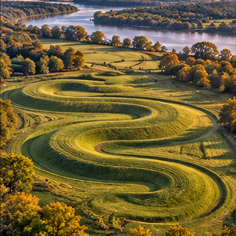
The collection opens with one of North America's most recognizable effigy earthworks: a long, sinuous serpent laid across a ridge above Brush Creek in Adams County, Ohio. Its physical existence is certain; its precise age and original meaning remain subjects of archaeological investigation.

Artist’s reconstruction and interpretive scale diagram. The archaeological comparison table and research notes remain live HTML below for readability and future revision.

Site Record · Great Serpent Mound

Monument typeEffigy Earthwork
LocationAdams County, Ohio
Overall lengthApprox. 1,348 ft
Surviving heightApprox. 3 ft
ConstructionEarth & Stone
Meaning / PurposeUnknown
Dating note: archaeological dating has produced competing interpretations, including Adena-era and Fort Ancient-era possibilities. The collection keeps that ongoing study visible rather than assigning a single date as settled fact.
Giant association: none is presently established. Any historical account tied specifically to this site would be evaluated independently in the Historical Witnesses collection.

Collection Table 01

Great Serpent Mound - Archaeological Profile

Category What Is Known Approx. Measurement / Date Evidence What Remains under study
Monument TypeLarge serpent-shaped effigy earthwork built along a ridge above Brush CreekApprox. 1,348 ft overall lengthMeasured surviving monument and archaeological surveyOriginal appearance and whether all visible portions belong to one construction phase
Height / WidthLow earthen embankment forming the serpent bodyAbout 3 ft average surviving height; roughly 20–25 ft wide in placesSite measurementsOriginal height before erosion and later disturbance
DatingArchaeological dates have supported more than one cultural attributionAdena-era and Fort Ancient-era interpretations have both been proposedRadiocarbon dating, excavation, stylistic and contextual comparisonWhether the monument was first built earlier and later repaired or modified
Head / Oval FeatureThe serpent’s head is associated with a large oval-shaped earthwork featureProminent feature at the eastern endVisible monument plan and early surveysWhether the oval represented an egg, sun, eye, prey, ceremonial enclosure, or something else
Burial EvidenceNo human burial is established within the serpent effigy itselfNone confirmed in the effigyArchaeological excavationThe broader ceremonial relationship between the effigy and nearby burial mounds
Astronomical OrientationThe serpent’s head and oval align toward the setting sun at the summer solsticeSummer Solstice SunsetMeasured orientation; recognized by Ohio History Connection and the National Park ServiceAdditional proposed solar and lunar alignments are less certain
PurposeClearly monumental and symbolic, but no written explanation from its builders survivesUnknownArchaeology, landscape setting and comparative interpretationReligious, cosmological, territorial, ceremonial or multiple functions
Giant AssociationNo established archaeological giant association is assigned to Great Serpent MoundNone presently establishedCollection reviewAny future historical account tied specifically to the site would require independent source evaluation
Interpretive astronomical orientation graphic. The primary summer-solstice sunset alignment and the more tentative secondary alignments are explained in live HTML beside and below the image.

Landscape & Sky

The Serpent Faces the Summer Solstice Sunset

The strongest astronomical relationship associated with Great Serpent Mound is solar: the serpent’s head and oval are aligned toward the setting sun at the summer solstice. The National Park Service and Ohio History Connection both recognize this relationship in their public interpretation of the site.

Strongly documented orientation Head & Oval → Summer Solstice Sunset

Other solar and lunar relationships have also been proposed for bends in the serpent’s body. Those secondary alignments are treated more cautiously because shorter sight lines allow greater interpretive flexibility.

ProposedSummer-solstice sunrise relationships
ProposedEquinox sunrise relationships
ProposedWinter-solstice sunrise relationships
ProposedLunar-cycle relationships
Why this matters: the monument was not simply a serpent-shaped embankment placed without orientation. Its relationship to the horizon and seasonal sun is part of the archaeological discussion of how the site was conceived and experienced.
06Exhibit 06Monks MoundCahokia, Illinois

Monks Mound & the Lost City of Cahokia

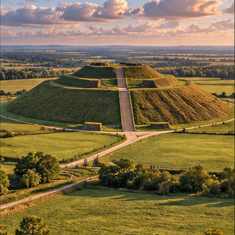
Monks Mound is the monumental centerpiece of Cahokia, the largest pre-Columbian urban complex north of Mexico. The mound rises about 100 feet above the surrounding landscape and sits within a city that once spread across roughly 4,000 acres and contained about 120 mounds.

Artist’s reconstruction and interpretive diagram of Monks Mound and Cahokia. The measurements and archaeological notes below remain live HTML so they can be revised independently from the artwork.

Cahokia in Context

More Than a Mound

Monks Mound was a massive platform at the heart of Cahokia. Its broad summit supported important wooden structures, while plazas, neighborhoods, palisades, causeways and many other mounds formed a much larger urban and ceremonial landscape.

At Cahokia’s height, approximately AD 1050–1150, population estimates for the city itself range from about 10,000 to 20,000 people. When surrounding settlements are included, the wider Cahokia region was larger still.

The modern name Monks Mound comes from Trappist monks who lived near the mound in the early nineteenth century; it is not the name used by its Mississippian builders.

~100 FTPresent height
~15 ACRESApproximate base area
4 TERRACESMajor surviving form
~120Mounds once recorded at Cahokia
~4,000 ACRESOriginal Cahokia complex
10–20KEstimated peak population of Cahokia proper
Measurement note: historical surveys and modern studies give somewhat different base dimensions because the mound’s profile has changed and different measurement methods have been used. Official descriptions commonly summarize the base as roughly 1,000 × 700 feet, while detailed surveys report slightly different dimensions. The exhibit therefore uses approximate values rather than implying false precision.

Collection Table 02

Monks Mound - Archaeological Profile

Category What Is Known Approx. Measurement / Date Evidence What Remains under study
Height Largest surviving mound at Cahokia About 100 ft / 30.5 m Modern survey and site documentation Original summit profile and exact ancient height
Base Massive rectangular platform covering roughly fifteen acres Often summarized as roughly 1,000 × 700 ft Historic and modern measurements Measurements vary slightly among surveys
Construction Built from transported earth in repeated construction episodes Multiple building stages; broadly within the Mississippian occupation Archaeological stratigraphy and coring Exact labor organization and construction tempo
Summit Supported large wooden structures associated with elite, civic or ceremonial activity Large summit platform Post patterns and archaeological interpretation Exact appearance and function of every summit structure
Cahokia Large Mississippian city surrounding Monks Mound About 4,000 acres; roughly 120 mounds originally Archaeological mapping and historical documentation Population and urban extent changed through time
Peak Population Cahokia proper supported an urban population comparable to major cities of its era About 10,000–20,000; peak especially AD 1050–1150 Archaeological population estimates Exact population at any single moment
Giant Association No established archaeological giant association is assigned to Monks Mound None presently established Collection review Historical accounts, if located, must be assessed independently

Interpretive Questions

Questions Raised by Cahokia

⌂

Why build so high?

What did elevation communicate about authority, ceremony and the organization of Cahokia’s urban landscape?

♟

Who organized the labor?

How was a workforce coordinated to move and place such extraordinary quantities of earth without wheeled transport?

◎

Why here?

What made this location near the Mississippi River system suitable for one of North America’s largest ancient cities?

⌛

Why did Cahokia decline?

Environmental change, social transformation, political instability and other explanations continue to be investigated.

07Exhibit 07Poverty PointLower Mississippi Valley, northeastern Louisiana

Poverty Point - A Landscape Built by Design

More than three thousand years ago, Indigenous hunter-fisher-gatherers transformed a natural ridge in northeastern Louisiana into a monumental landscape of mounds, six concentric C-shaped ridges and an enormous central plaza.

Interpretive museum reconstruction. Measurements, dates and orientation notes below remain live HTML.

The Created Landscape

Engineering Before Agriculture

The principal Poverty Point earthworks were created and used roughly between 1700 and 1100 BCE. Their builders were hunter-fisher-gatherers, yet they constructed a planned monumental complex unmatched in North America at the time.

Six concentric, semi-elliptical ridges surrounded a large plaza. Mounds rose around this designed landscape, while artifacts reveal a far-reaching exchange network bringing stone and other materials from hundreds of miles away.

Mound A - the largest mound at Poverty Point - stands about 72 feet high and measures roughly 710 feet long by 660 feet wide.

1700–1100 BCEPrincipal construction and use
6 RIDGESConcentric C-shaped earthworks
~43 ACRESCentral plaza
72 FTMound A height
710 × 660 FTMound A footprint
400+ ACRESMonumental landscape
Exhibit note: the artwork is an interpretive reconstruction. The monumental ridges, plaza, mounds and planned landscape are archaeological features; exact ancient surface appearance cannot be reconstructed with certainty.

Orientation & Planned Geometry

A Monumental Landscape with Deliberate Alignments

Established: the six C-shaped ridges, central plaza and major mounds form an intentionally organized geometric landscape.

Cardinal relationship: Louisiana archaeological documentation notes that Mound A was built in a direct north–south line with Mounds B and E.

Possible astronomical use: unusually large postholes in the plaza have been interpreted as possible timber calendar markers for events such as solstices and equinoxes. This remains an interpretation, not a firmly established astronomical alignment.

Collection Table 03

Poverty Point - Archaeological Profile

CategoryWhat Is KnownApprox. Measurement / DateEvidenceWhat Remains under study
Principal AgeLate Archaic monumental complexAbout 1700–1100 BCEExcavation, radiocarbon dating and stratigraphyExact chronology of every construction episode
Ridge SystemSix concentric C-shaped earthen ridges surrounding a plazaSix ridges with four principal aislesSurvey, excavation and remote sensingDetailed function of each ridge through time
Central PlazaLarge deliberately prepared open spaceAbout 43 acresArchaeological and topographic studyFull range of activities conducted there
Mound ALargest mound at Poverty PointAbout 72 ft high; 710 ft long; 660 ft wideExcavation, coring and surveySymbolic meaning of its unusual form
ConstructionEnormous quantities of earth were carried and placed without wheeled transport or draft animalsMillions of basket loads estimated for Mound AVolume studies and experimental estimatesExact workforce and labor organization
Exchange NetworkNonlocal stone and raw materials arrived from extensive areas of eastern North AmericaHundreds of milesArtifact sourcingSocial mechanisms behind exchange
OrientationMound A lies on a direct north–south line with Mounds B and ECardinal north–south relationshipMapped geometry and Louisiana archaeological documentationFull symbolic or practical purpose
Astronomical InterpretationLarge plaza postholes have inspired calendrical interpretationsSolstice/equinox functions proposedPosthole patterns and spatial analysisWhether specific astronomical events were intentionally marked
Giant AssociationNo established archaeological giant association is assigned to Poverty PointNone presently establishedCollection reviewHistorical accounts require independent original-source evaluation
08Exhibit 08Silbury HillAvebury, Wiltshire, England

Silbury Hill - The Monument Without an Answer

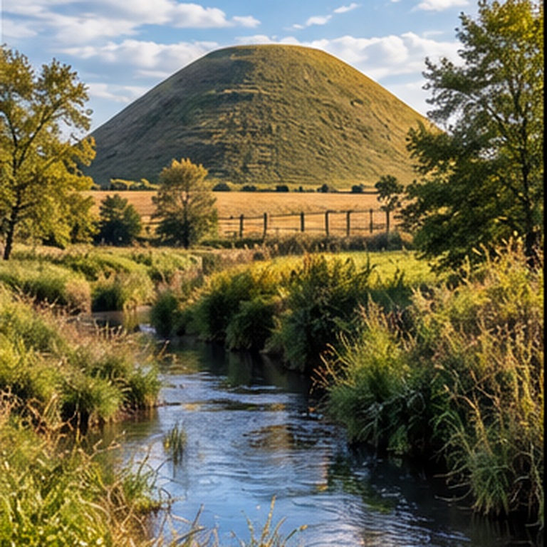
Rising from the ceremonial landscape of Avebury in Wiltshire, Silbury Hill is the largest prehistoric artificial mound in Europe. Built in the late Neolithic from chalk, soil and turf, its extraordinary scale is well documented. Its original purpose is not.

Interpretive museum reconstruction. Archaeological measurements and conclusions are maintained below as live HTML.

A Monumental Undertaking

Half a Million Tonnes - Purpose Unknown

English Heritage places the main construction of Silbury Hill at approximately 2470–2350 BC. The monument was enlarged through successive construction episodes rather than raised in a single operation.

English Heritage estimates that roughly 500,000 tonnes of material - principally chalk - were used, requiring on the order of four million hours of human labor.

Despite centuries of digging into the mound, no central royal burial or treasure chamber has been demonstrated. The absence of an obvious answer is one of the reasons Silbury remains so compelling.

2470–2350 BCPrincipal construction range
30+ MHeight · English Heritage general description
~160 MWidth · English Heritage general description
~500,000 TMaterial used
~4 MILLIONEstimated labor hours
NO KNOWNCentral burial
Measurement note: published measurements vary with survey method and what is treated as the mound's base. English Heritage describes Silbury as over 30 m high and about 160 m wide; the Historic England scheduled-monument record gives 39.3 m high and 167.6 m in diameter.

Orientation & Landscape Position

The Setting Is Important - A Specific Astronomical Alignment Is Not Established

Established: Silbury Hill occupies a carefully chosen position on a slight natural spur on the western side of the Kennet valley and belongs to the extraordinary Avebury ceremonial landscape.

Landscape relationship: nearby monuments - including Avebury henge, West Kennet Avenue, the Sanctuary and West Kennet Long Barrow - formed part of a densely monumentalized Neolithic landscape. West Kennet Long Barrow itself has views toward Silbury Hill.

Astronomical caution: solar and astronomical interpretations have been proposed historically, but the official archaeological records do not establish a specific solstice, equinox or cardinal alignment for Silbury Hill. The museum therefore records those ideas as hypotheses rather than architectural facts.

Collection Table 04

Silbury Hill - Archaeological Profile

CategoryWhat Is KnownApprox. Measurement / DateEvidenceWhat Remains under study
DateLate Neolithic construction, enlarged through successive episodesAbout 2470–2350 BCModern excavation, environmental evidence and scientific datingExact duration and social organization of every building episode
HeightLargest prehistoric artificial mound in EuropeOver 30 m; Historic England scheduled record: 39.3 mModern topographic survey and official monument recordsDifferences depend partly on measurement datum and definition of the base
Diameter / WidthMassive roughly circular, flat-topped moundAbout 160 m; scheduled record: 167.6 m diameterSurvey and monument mappingOriginal summit profile is under study
Material / MassConstructed principally from chalk with soil and turf componentsAbout 500,000 tonnesConstruction studies and English Heritage estimatesExact quantities placed during individual phases
Estimated LaborConstruction demanded extraordinary organized human effortAbout 4 million labor-hoursEnglish Heritage construction estimateWorkforce size, seasonal schedule and social obligations of builders
Construction MethodThe mound developed through multiple enlargements; retaining elements helped control materialSeveral generations of constructionExcavation and structural investigationHow the work was directed and what ceremonies accompanied construction
Surrounding DitchA broad quarry ditch supplied much of the mound material and surrounds the monumentDitch system extends well beyond the moundVisible earthworks, excavation and surveyWhether water in portions of the ditch had symbolic importance
Burial EvidenceNo central elite burial has been demonstrated despite repeated attempts to find oneNo established primary burialHistoric tunnels, shafts and modern archaeological investigationWhether burial ever formed any part of the monument's purpose
Avebury RelationshipSilbury stands within one of Britain's richest Neolithic ceremonial landscapesNear Avebury henge, West Kennet Avenue, the Sanctuary and West Kennet Long BarrowLandscape archaeology and World Heritage documentationThe precise functional relationship among the monuments
Orientation / AlignmentIts landscape placement is clearly significant; no single astronomical orientation is established by official archaeological interpretationNo confirmed solstice/equinox axis assignedLandscape survey and official archaeological recordsWhether celestial observation influenced siting or design
Historic ExcavationsAntiquarian and modern investigators repeatedly entered the mound searching for its origin and purposeMajor investigations include 1776–77, 1849 and 1968–70Excavation records and surviving tunnelsDamage and incomplete documentation complicate interpretation
2000 CollapseThe old Duke of Northumberland shaft reopened after heavy rain, creating a dangerous summit cavity and prompting conservation workCollapse began May 2000English Heritage monitoring, geophysical work and conservation recordsLong-term effects of older intrusive excavations required extensive investigation
Original PurposeThe scale indicates enormous social and cultural importanceUnknownMonumental investment and landscape contextWhy it was built remains under continued study
Giant AssociationNo established archaeological association with giantsNone establishedArchaeological recordLater legends or historical accounts must be evaluated separately from the excavated evidence

Questions Raised by the Evidence

Four Questions Silbury Still Refuses to Answer

01 · PurposeWhy devote millions of hours to a monumental mound with no known central burial?
02 · SummitWhat activities, ceremonies or gatherings - if any - took place on or around its summit?
03 · LandscapeWhy was this precise position within the greater Avebury ceremonial landscape selected?
04 · MeaningWas Silbury designed to contain something - or was the enormous act of building it itself the message?

Global Survey

A World of Constructed Landscapes

“Mound” describes several very different kinds of monuments. The collection therefore separates effigy earthworks, platform mounds, burial mounds, monumental artificial hills and large geometric earthwork complexes rather than treating them as one tradition.

01 · EFFIGY

Serpent Mound

Ohio · United States

A monumental serpent-shaped earthwork whose age continues to be studied.

~1,348 ftLength
under continued studyDate
02 · PLATFORM

Monks Mound

Illinois · United States

The dominant monument at Cahokia and the largest prehistoric earthen structure in the Americas.

~100 ftHeight
4 terracesForm
03 · EARTHWORK COMPLEX

Poverty Point

Louisiana · United States

Large mounds, six semi-elliptical ridges and an immense plaza built by Late Archaic hunter-fisher-gatherers.

3,700–3,100Years ago
1.14 kmOuter ridge diameter
04 · ARTIFICIAL HILL

Silbury Hill

Wiltshire · England

Europe's largest artificial prehistoric mound, built in stages in the late Neolithic.

~30 mHeight
~500,000 tMaterial
05 · PASSAGE MOUND

Newgrange

County Meath · Ireland

A monumental passage tomb and mound, cross-linked here because its architecture is inseparable from its constructed earthen and stone envelope.

NeolithicPeriod
Cross-linkDolmens / Tombs
06 · WORLD INDEX

More to Enter

Global Collection

Cahokia's wider mound field, Hopewell and Adena works, Grave Creek, Moundville, Etowah, Eurasian kurgans, Japanese kofun and additional traditions will expand this index.

GlobalScope
ExpandableDatabase

Collection Table 01

Scale, Age & Construction

The table is designed to become one of the collection's recurring tools. Measurements are presented with approximate markers where site boundaries, surviving profiles or scholarly estimates vary.

SiteLocationApprox. Date / AgeTypeHeight / ScaleMaterial / VolumeBurial?Giant Association
Great Serpent MoundOhio, USADating under continued studyEffigy earthwork~1,348 ft long; ~3 ft highEarth & stoneNo burial established within serpent effigyNone established
Monks MoundIllinois, USAMississippian; Cahokia flourished especially c. AD 1050–1150Platform mound~30 m / ~100 ft high; four terracesEarthen constructionPart of larger Cahokia complex with multiple mound functionsSeparate accounts require review
Poverty PointLouisiana, USA~3,700–3,100 years agoMounds + concentric ridgesOuter ridge system ~1.14 km diameterLarge integrated earthwork complexNot classified here as a simple burial moundNone assigned
Silbury HillWiltshire, Englandc. 2470–2350 BCArtificial prehistoric mound~30 m high; ~160 m wide~500,000 tonnes, mostly chalkNo central burial foundLater tradition separated
NewgrangeCounty Meath, IrelandNeolithicPassage tomb / moundMonumental circular moundEarth, stone & megalithic chamberYes - funerary monumentFolklore reviewed separately

Research Standard

How the Collection Separates Evidence

Every monument can accumulate archaeology, early excavation reports, folklore and modern exploration. The collection keeps those layers visible instead of blending them.

01 · ArchaeologyPhysical monument, excavation, dating, materials and measured dimensions.
02 · Historical RecordEarly surveys, antiquarian accounts, newspapers and named witnesses.
03 · Ancient TraditionTexts or traditions demonstrably associated with the monument or culture.
04 · Later FolkloreStories attached to the monument in later centuries, dated when possible.
05 · HypothesisModern interpretations and under continued study possibilities, explicitly identified as such.

Interpretive Gallery

Deep Questions to Ponder

These questions are not answers. They identify the places where scale, landscape, chronology and human intention invite closer investigation.

⌖

Why this exact place?

Did builders select ridges, waterways, horizons and natural landmarks because the surrounding landscape formed part of the monument's meaning?

◉

Why build at such scale?

What social or ceremonial purpose justified generations of organized labor and the movement of enormous quantities of earth?

☀

Were alignments intentional?

Which solar, lunar or geometric relationships are supported by measurement - and which may be patterns imposed by modern observers?

⌛

One monument - or many phases?

Could later cultures have enlarged, repaired or reinterpreted earthworks first created by earlier populations?

△

How much has vanished?

Erosion, agriculture, excavation and modern development can alter profiles dramatically. Are we seeing the monument's original form or only its surviving core?

?

What did it mean?

Burial place, ceremonial center, political monument, cosmological landscape - or several functions at different times?